Cross Country Tour
w/ Bike America
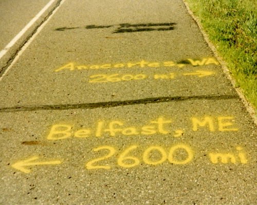
Anacortes, WA to Belfast, ME
3 June - 5 August, 1990
4,051.2 Miles
Total Tour

As a prelude to this bicycle tour I quit a high paying high stress job that was killing me in small torturous ways, giving two days notice to my boss and walking away on 31 March. I had received a brochure from Bike America earlier in the year and had considered doing 3-4 week/state tours with them but when I quit I committed to do the cross country. Here is the brochure description of the tour which will set the stage better than my faulty memory.
'The ultimate way to see America is on a bicycle and the Bike America Tour is America's most beautiful cross-country bicycle ride.
We have selected the most scenic and safe back road course across America, not one that gets you from Pacific to Atlantic in the shortest possible distance.
You will bike America from sea to shining sea - ride through the spectacular mountains and national parks of the far West, across the spacious plains to the fruitful farmlands and sparkling lakes of the Midwest, finishing in the graceful mountains and peaceful valleys of the East
As a cross-country rider you will meet a new group of cross-state tourists each week who are on one or more of our week-long state tours. This means you will meet upwards of 2,000 other bicyclist over the course of the summer!
Past cross-country riders have commented that riding across America was the greatest experience of their life. They enjoyed an exceptional bike ride each day, made new lifetime friends, saw America as never before, and most importantly, they accomplished a great personal achievement for themselves!'
I am going to re-create a journal from some distance data that I kept, the map handouts that we were given, the pictures that I took (with very brief captions written on the back some time more recently that 20 years later) and my faulty memory. I'll do this in the same fashion that Bike America did the tour - by state.
Week 1: Washington
 Total distance: 471.1 miles
Week 1 Route
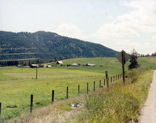
I left Sacramento, CA on an AMTRAK train for Seattle the evening of 31 May and was picked up there by a cousin that lived nearby. On the 1 June she took me to visit some of her in-laws and to see some of the local sights; then on 2 June she drove me to the Anacortes Middle School where the Bike America campground was in Anacortes, WA.
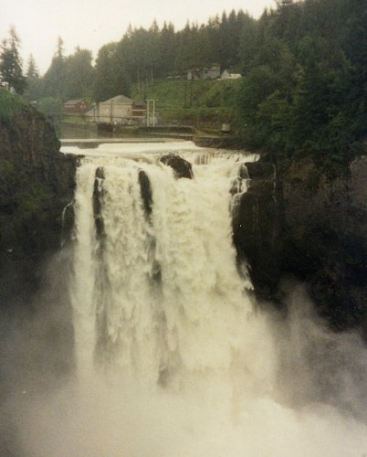
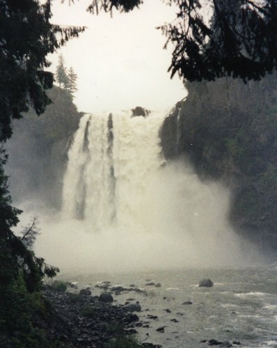
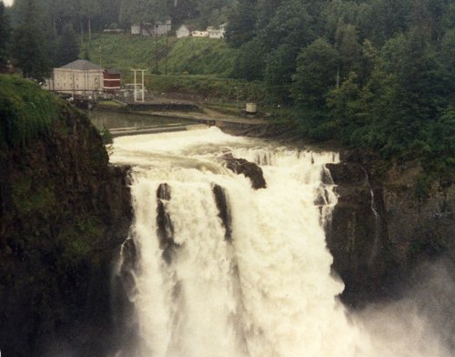
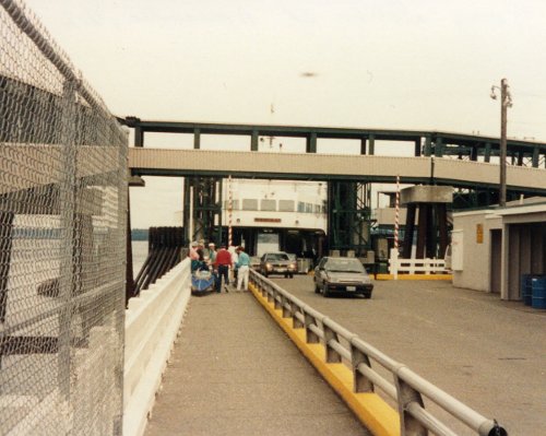
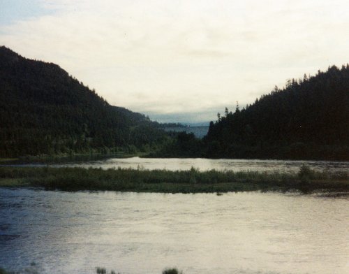
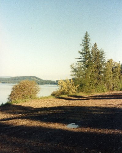
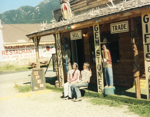
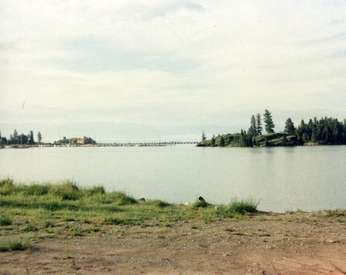
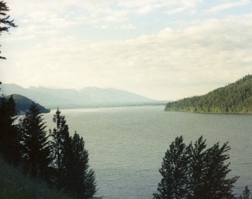
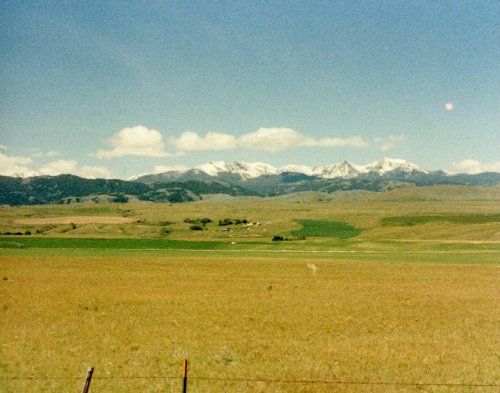
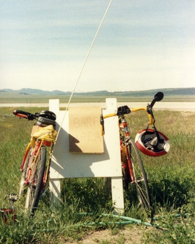
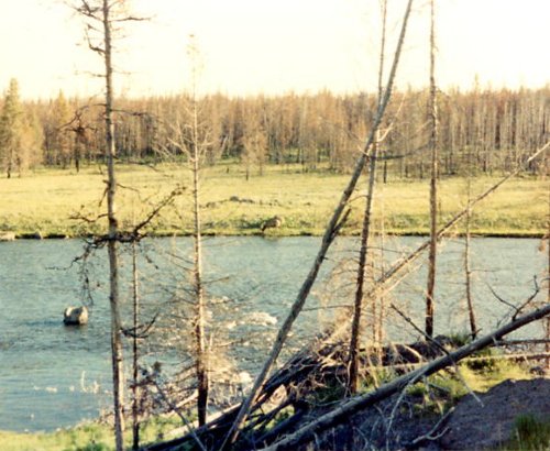
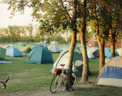
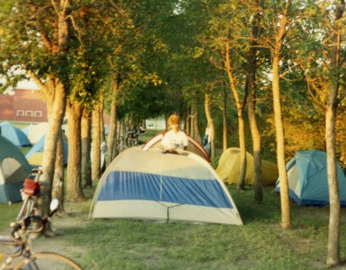
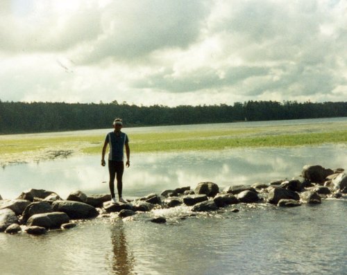
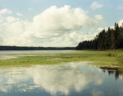
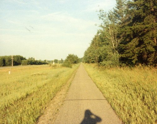
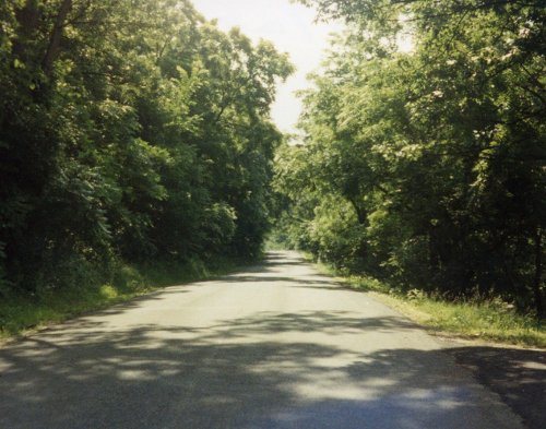
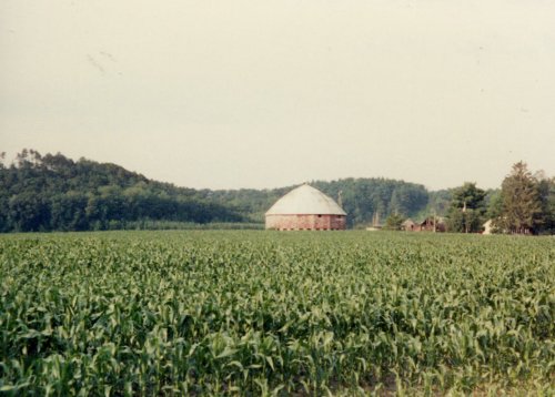
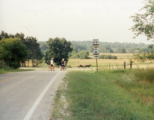
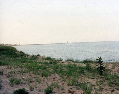
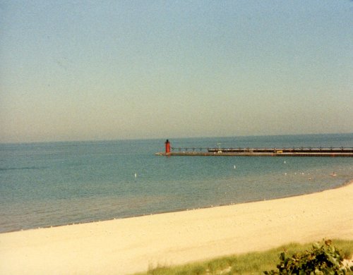
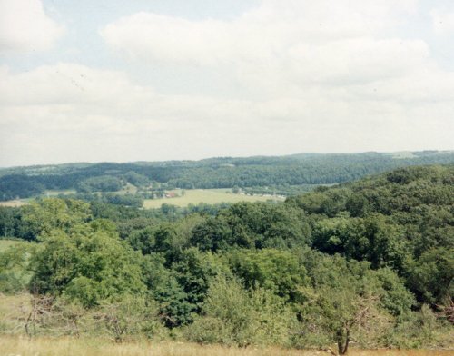
 Three pictures of Snoqualmie Falls. This is the falls that is pictured in the opening shots of 'Twin Peaks', a TV show. This was our starting point, the ferry dock at Anacortes, WA.
John & Janice of Placerville, CA arrived yesterday afternoon and set up their tent next to mine. They had ridden their tandem from Placerville to Anacortes; over 1,000 miles to start this cross country ride and were considering riding back to Placerville from Maine. Since I was living in Roseville, CA prior to this ride we were practically neighbors and developed a friendship that continued after the ride.
3 Jun: Anacortes to Newhalem
Roads: WA20
Distance: 76.2 miles
Camp: A large field - rain
(There were no services in Newhalem; portable toilets, showers and caterers were brought in by the tour organizers.

4 Jun: Newhalem to Winthrop
Roads: WA20
Distance: 75.0 miles
Camp: Winthrop KOA - rain and snow
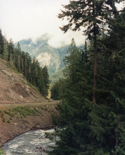
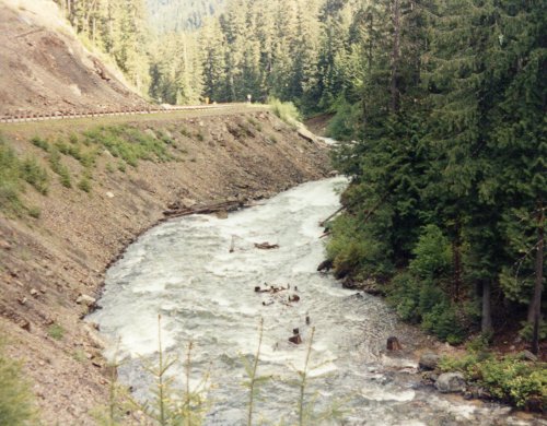
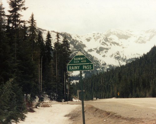
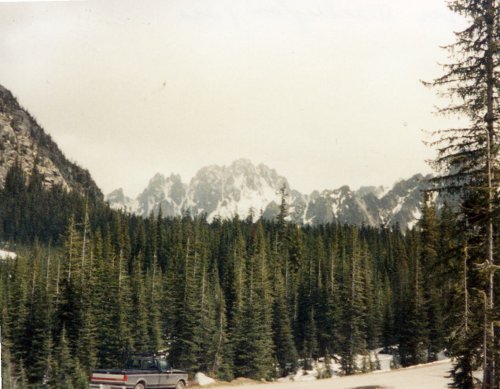
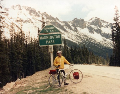
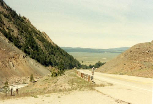
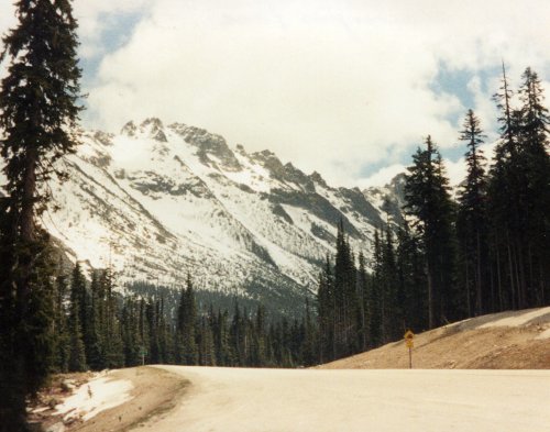 Two pictures of the climb up through the North Cascades. The first major pass of the day at the 43 mile mark and over 4,300 feet of climbing - Rainy Pass. Well named because we had rain most of the way to the summit that turned to snow. Two pictures of the climb up the western slope to Washington Pass and the summit Washington Pass, the second pass of the day.
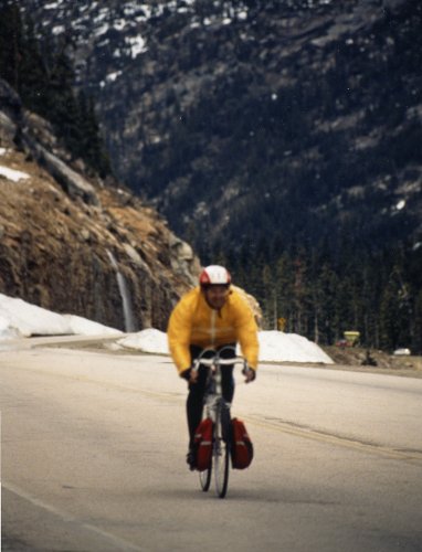
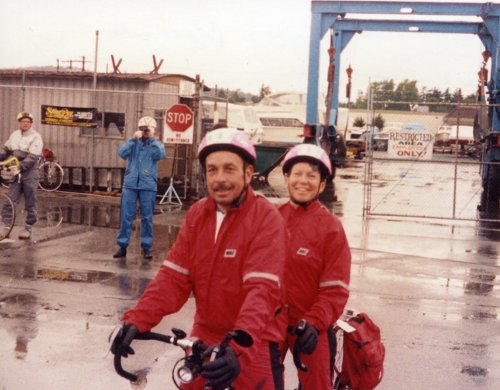
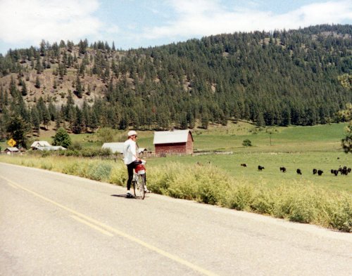
 A commercial photographer was set up on the east slope of Washington Pass and took my picture on the left which he then had posted for sale at our camp in Winthrop.
5 Jun: Winthrop to Coulee Dam
Roads: WA20, EWA153, US97 & WA173/174
Distance: 101.6 miles (our first Century)
Camp: Lake Roosevelt High School - NO rain
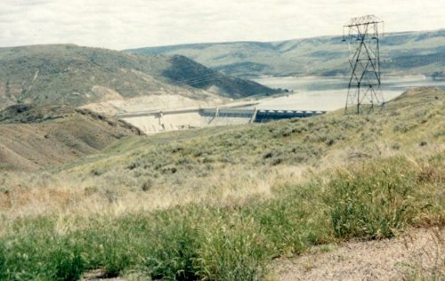
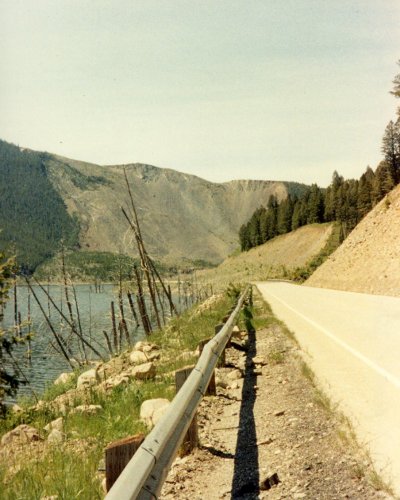
 Coulee Dam with only a few more miles to go to complete our first 100 mile day on this tour. This was the first day that we didn't have any rain and it was hot after what we have been having. The second picture of the Columbia River is from Cash Creek Rd which had a section of 13% grade.
6 Jun: Coulee Dam to Republic
Roads: WA155, Cache Creek Rd & WA 21
Distance:72.0 miles
Camp: Fairgrounds - rain
7 Jun: Republic to Chewelah
Roads: WA20 & US395
Distance: 92.2 miles
Camp: Chewalah High School - rain
The route was changed today because of the bad weather.
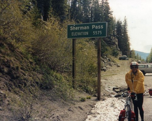 Our third major pass in Washington. The four pictures are of the Sherman Pass area, the only pass that I was able to get a good view from because of the rainy weather.
8 Jun: Chewelah to Newport
Roads: US395, Garden Spot Rd/Others & US2
Distance: 54.1 miles
Camp: Newport Middle School - rain
9 Jun: Newport
Roads: None
Distance: None
Camp: Newport Middle School - rain
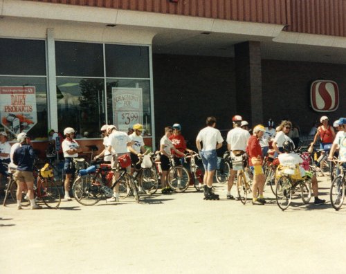
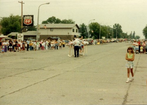
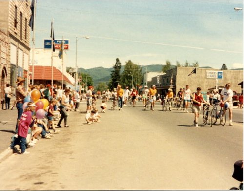 Two pictures of the parade in Newport, WA on our rest day that we participated in (I think it was a Flag Day Parade).
Week 2: Idaho

& N.W. Montana

Total distance: 340.0 miles
Week 2 Route
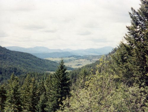
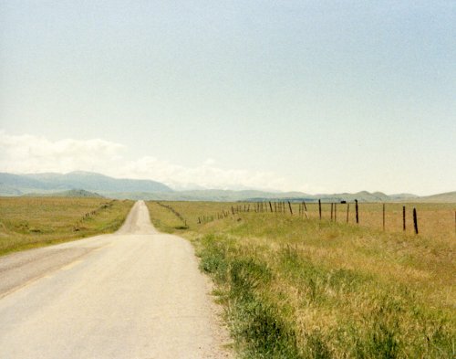
This second week was listed in the brochure as the 'Rocky Mountain Tour' and was to pass through the following towns: Noxon-MT, Libby-MT, Eureka-MT, Blairmore-Alberta, Waterton Lakes National Park-Alberta, St. Mary-MT, & through Glacier National Park to Columbia Falls-MT. Going to the Sun Road through Glacier National Park continued to be closed with snow drifts so the tour director made arrangements and changed the weeks itinerary to what I have presented below.
10 Jun: Newport to Noxon
Roads: US2 & MT200
Distance: 80.4 miles
Camp: Some school - rain
11 Jun: Noxon to Libby
Roads: ID200/MT200, MT56 & US2
Distance: 44.7 miles
Camp: Some school - rain
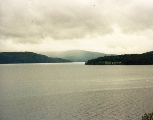
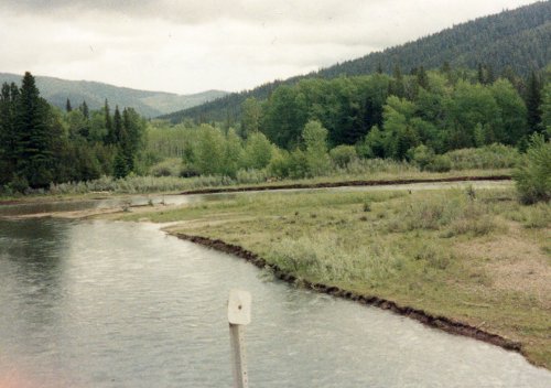
 Two pictures of Lake Pend Oreille, ID200 follows the shore almost all the way across the Idaho Panhandle. The first picture is near Hope, East Hope and Beyond Hope Idaho; the second is near Clark Fork where we finally leave the lake shore.
12 Jun: Libby
Roads: None
Distance: None
Camp: Same school - rain
We had a day off while the tour organizer was trying to make arrangements for a modified route.
13 Jun: Libby to Eureka
Roads: MT37, Forest Road228, MT37 & US93
Distance: 76.1 miles
Camp: Another school - rain
The heaviest that we have had which flooded the foot of my tent but I was able to stay dry.
14 Jun: Eureka to Kalispell
Roads:US93
Distance: 66.0 miles
Camp: A High School - NO rain
I stopped in Whitefish and had my bottom bracket repacked with grease because of all the water and grit that I have been riding through.
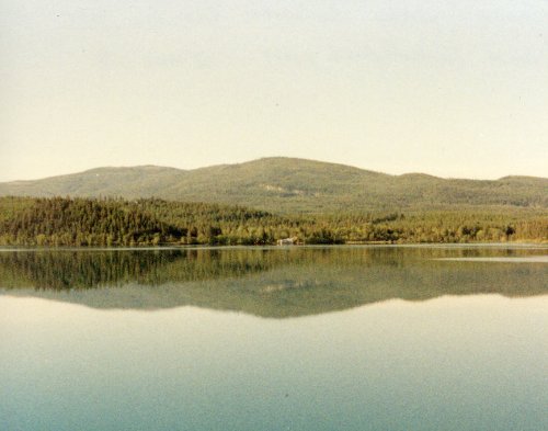
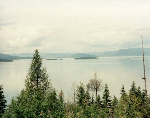
 A couple of lakes between Eureka and Whitefish on a clear day with no rain for a big change.
15 Jun: Kalispell to Apgar and return
Roads: US93, MT40, US2 & Glacier Park Rd
Distance: 72.8 miles
Camp: Same high School - NO rain
This was another day off or do a round trip ride into Glacier National Park. Going to the Sun Road was still closed but a few riders road up to the point where the snow bank was.
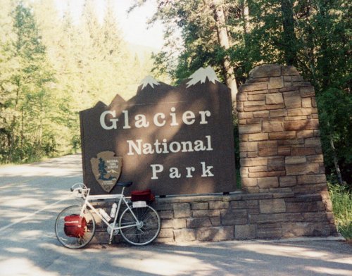
 Three pictures on the ride up to Glacier National Park. A trading post at Hungry Horse, MT. There was a large sign as you entered the town that said 'Best Little Town By A Dam Site'.
16 Jun: Kalispell
Roads: None
Distance: None
Camp: Same High School - rain
This would have been our normal rest day before starting week 3.
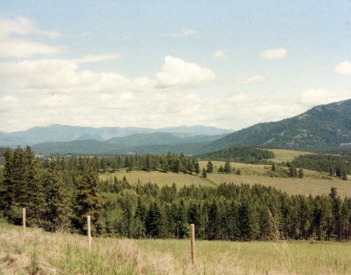
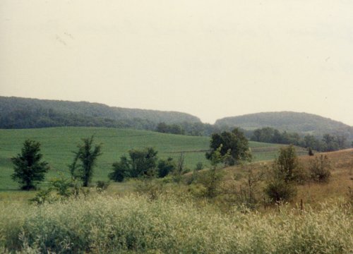
Week 3: W. Montana
Total distance: 466.5 miles
Week 3 Route
Week three was listed as the Park to Park Tour and overlapped one day with week two. The last day of week two was the ride through Glacier National Park to Columbia Falls, MT with the first day of week three to be that same ride. Because Going to the Sun Road was closed the third week began in Kalispell.
17 Jun: Kalispell to Big Fork
Roads: US93 & MT35
Distance: 87.8 miles
Camp: Big Fork High School - sprinkles
I road around Flathead Lake to get to Big Fork. The direct route would have been 22 miles, the alternative through Apgar I had done - I rode alone and don't think anyone else did this route.

 I took 5 pictures as I rode around Flathead Lake from Kalispell to Big Fork. In the row above, first is of the west side between Kalispell and Polson. Second is just before a nice downhill into Polson at the southern end of the lake and the Mission Mountains on the east side of the lake. Then Flathead Lake between Polson and Big Fork. There were a lot of cherry orchards along the shore in this area.
18 Jun: Big Fork to Seeley Lake
Roads: County209 & MT83
Distance: 75.1 miles
Camp:Seeley Lake High School
19 Jun: Seeley Lake to Lincoln
Roads: MT83 & MT200
Distance: 55.2 miles
Camp: Lincoln High School
20 Jun: Lincoln to Townsend
Roads: MT200, MT279, County279 & US287/12
Distance: 91.0 miles
Camp: Townsend High School
21 Jun: Townsend to Ennis
Roads: US287
Distance: 77.2 miles
Camp: Ennis High School

22 Jun: Ennis to West Yellowstone
Roads: US287, US191 & US20
Distance: 80.2 miles
Camp: Lionshead KOA
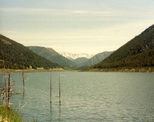
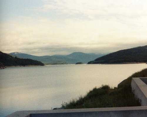
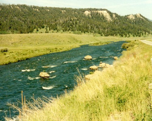
 Two pictures of Quake Lake that was formed by the earthquake in Madison Canyon. Then the Madison River as it flows into Hebgan Lake, man made, up-stream from Quake Lake.
23 Jun: West Yellowstone
Roads: None
Distance: None
Camp: Lionshead KOA
What a blessing, no rain this week except for a few sprinkles on the first day.
Week 4: Wyoming

& E. Montana
Total distance: 340.0 miles
Week 4 Route
This week 4 was shown to end in Beach, ND in the brochure however we finished in Sidney, MT; the remainder of the route was as listed.
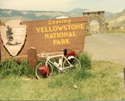
24 Jun: West Yellowstone to Gardiner
Roads: Through Yellowstone
Distance: 63.5
Camp: Gardiner High School - wind

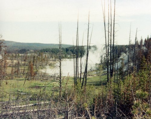
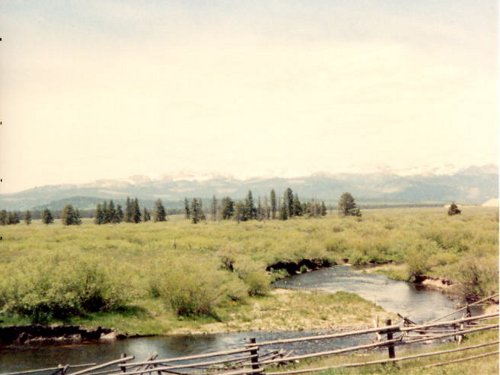
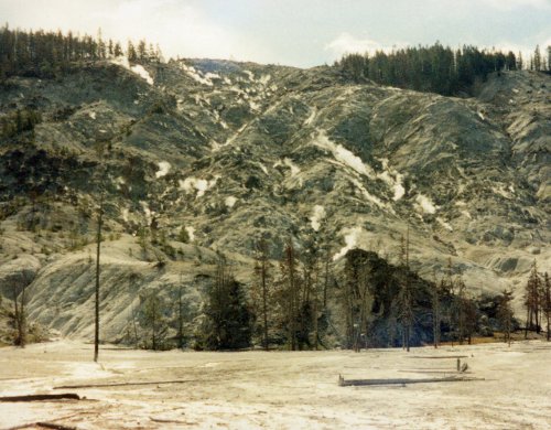 In the first picture there is an elk in the center of the picture right at the water edge. The second one has a gaggle of geese just back from the water a few feet. In both pictures you can see the aftermath of the fire in Yellowstone during the summer of 1988. One of the many steaming vents in Yellowstone and more of the fire destruction. This was not a good year to come and see Yellowstone and it is going to be some years for the damage to heal. I think this last picture is of Roaring Mountain.
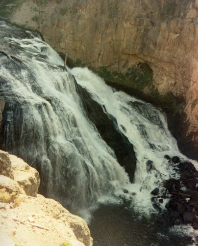
 The first picture is Gibbon Falls - maybe. The wildflowers were trying to make up for the unsightly burn damage; these were at Mammoth Hot Springs. The mountain peaks of Yellowstone from near the North Entrance and the North Entrance to Yellowstone not far from Gardiner.
25 Jun: Gardiner to Big Timber
Roads: US89 & I-90
Distance: 93.1 miles
Camp: Big Timber High School - wind & showers
26 Jun: Big Timber to Billings
Roads: I-90
Distance: 83.5 miles
Camp: Billings KOA - wind & showers
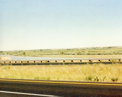
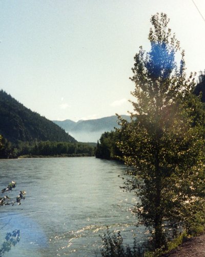
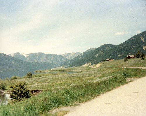
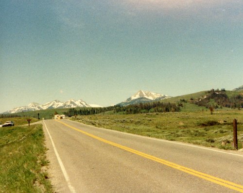
A last look at the Rocky Mountains from near Livingston. In this picture the Yellowstone River is just over the guardrail of I-90 or I-94. We rode these two Interstate Highways from Livingston to Glendive then continued along the Yellowstone almost to its junction with the Missouri. Bicycling the Interstates is much the same as driving them, you don't see much; the last hills were in Big Timber and the Yellowstone River can be seen only as a band of trees most of the time.
27 Jun: Billings to Forsyth
Roads: I-94
Distance: 102.2 miles (our second Century)
Camp: Forsyth High School - wind & rain
28 Jun: Forsyth to Terry
Roads: I-94
Distance: 84.1 miles
Camp: Terry High School
29 Jun: Terry to Sidney
Roads: I-94 & MT16
Distance: 90.0 miles
Camp: Sidney High School - rain
30 Jun: Sidney
Roads: None
Distance: None
Camp: Sidney High School
There were high winds in the early hours of 1 July and around 3:00 AM a tornado warning was issued that included Sidney. We were all told to pack up our tents and move into the High School which I thought was probably as dangerous as staying in the football field. I didn't get any more sleep inside and as soon as the sun started to come up I started to ride.
Week 5: North Dakota 
Total distance: 452.1 miles
Week 5 Route
This fifth week was listed in the brochure as the 'North Dakota Tour' and was to pass through the following towns: Beach-ND, Dickinson-ND, Bismarck-ND, Jamestown-ND & Fargo-ND. This would have been a boring ride on I-94 all the way across a rather boring piece of geography that just happens to lie between the Pacific and Atlantic. Fortunately the tour organizer changed the routing to what we rode and I will show below.
1 Jul: Sidney, MT to New Town, ND
Roads: MT23/ND68, US85 & ND23
Distance: 104.3 miles (third Century)
Camp: New Town High School - rain
2 Jul: New Town to Underwood
Roads: ND23, ND28, ND53 & US83
Distance: 99.8 miles
Camp: Underwood High School - rain

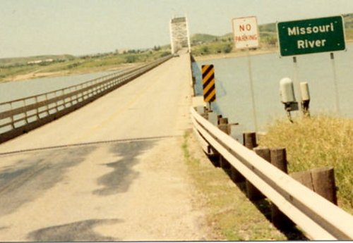
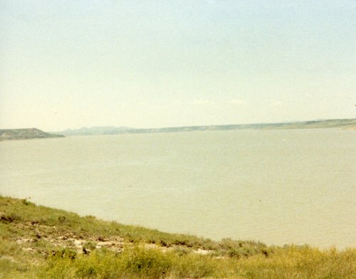 Two pictures that just about say it all about North Dakota. I didn't stop to take a picture but saw one lonesome pine tree beside the road from about a mile away; when I got to it there was a handmade sign hanging from it that said 'North Dakota State Forest'. We crossed the Missouri River once again. The last time was in Townsend, MT which seemed like a long, long time ago. This is lake Sakakawea near Underwood.
3 Jul: Underwood to Carrington
Roads:ND200
Distance:102.1 miles (fourth Century)
Camp: Carrington High School
 Two pictures of our camp in Carrington, a better than normal camp for shade particularly here in North Dakota.
4 Jul: Carrington to Cooperstown
Roads: ND200
Distance: 49.3 miles
Camp: Cooperstown High School
5 Jul: Cooperstown to Fargo
Roads: ND200, ND32, ND38, ND26 & ND81
Distance: 96.6 miles
Camp: Don't know, I think it was a school near downtown
6 Jul: Fargo
Roads: None
Distance: None
Camp: Same as 5 July
Saturday was our usual rest day, after riding for 6 days, but we had this Friday as a rest day, after riding for 5 days. We then rode for 7 days in week 6 before getting back to our Saturday rest day.
Week 6: Minnesota 
Total distance: 521.4 miles
Week 6 Route
This week 6 was shown to end the first day at Detroit Lakes and the last day at Lake City in the brochure however the first camp was in Mahnomen and we finished in Wabasha, MN; the remainder of the route was as listed.
7 Jul: Fargo to Mahnomen
Roads: County18, County87, MN9, MN26, MN32, MN113, County10/6 & County10
Distance:72.1 miles
Camp: Mahnomen High School -rain
 A parade in Mahnomen on July 7th. I'm not sure what the parade was for but that is the Polish Ski Team in the center of the picture.
8 Jul: Mahnomen to Park Rapids
Roads: MN200, Itasca State Park & US71
Distance: 74.2 miles
Camp: Park Rapids High School - rain
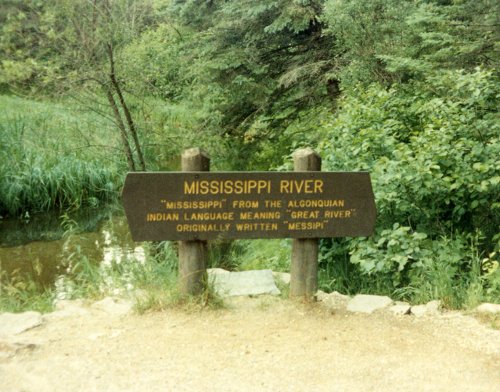
 Two pictures of the Mississippi River, in the second one I am walking across it.
9 Jul: Park Rapids to Pine River
Roads: Heartland Bike Trail to Walker & MN371
Distance: 64.0 miles
Camp: Pine River High School
10 Jul: Pine River to Little Falls
Roads: County1, MN115 & MN371
Distance: 65.6 miles
Camp: Little Falls High School - light rain
11 Jul: Little Falls to Annandale
Roads: MN28, MN238, County24/3, MN137, City Streets, County137, County6, County136, County115, MN7 & County 24/55
Distance: 69.0 miles
Camp: Annandale Park - rain
A very complicated route for this section. However, Cycle America marked each turn with yellow paint on the road before the turn so it was not difficult to follow IF you watched for the 'yellow arrows'.
12 Jul: Annandale to Northfield
Roads: County5, county35, County 7, county107, County8, County50, County45, County9, County10, County23, County8, county27, county2, county3, county46 & County19
Distance: 104.1 miles (fifth Century)
Camp: Northfield High School
Northfield was the hometown of Cycle America and the tour organizer had a party at Grunde's Corner Bar which I do not remember attending; it started at 8:00 PM and I was usually well asleep by that time especially after a 100 mile day. Northfield experienced one of its most important historical events on September 7, 1876. An outlaw gang led by Jesse James tried to rob the First National Bank of Northfield. Local citizens, recognizing what was happening, armed themselves and resisted the robbers, successfully thwarting the theft, but not before the bank's cashier, Joseph Lee Heywood and a Swedish immigrant, Nicholas Gustafson, were murdered.
13 Jul: Northfield to Wabasha
Roads: County28, County, 42, MN19, Cannon River Bike Trail- Cannon Falls to Red Wing & US61
Distance: 72.4 miles
Camp: Wabasha Middle School
 Two pictures of the Cannon River Bike Trail between Cannon Falls and Red Wing. The second picture was taken at our - point of the Cross Country Tour.
14 Jul: Wabasha
Roads: None
Distance: None
Camp: Wabasha Middle School
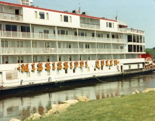
 Two pictures of the Mississippi Queen, a paddle wheeler, at its last port of call 'up river' in Wabasha.
Week 7: Wisconsin 
Total distance: 429.6 miles
Week 7 Route
This week 7 was shown to pass through the following towns: Lake City-MN, Galesville-WI, Elroy-WI, Baraboo-WI, Beaver Dam-WI, Sheboygan-WI and Kewaunee-WI. We did stop in Elroy, Beaver Dam and Kewaunee, the other stops were as shown below.
15 Jul: Wabasha, MN to Trempeleau
Roads: WI25, WI35, WI35/54, Perrot State Park & WI35
Distance: 56.9 miles
Camp: Trempeleau Middle School
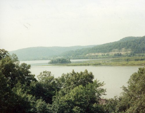
 Two pictures of Perrot State Park near Trempeleau. The first if looking through the park's trees to the Mississippi River and the second is the park road that took us to Trempeleau.
16 Jul: Trempleau to Elroy
Roads: WI93, County XX, McHugh Rd, County D/W, County M, LaCross River Trail & Elroy Sparta Trail
Distance: 77.8 miles
Camp: Elroy High School
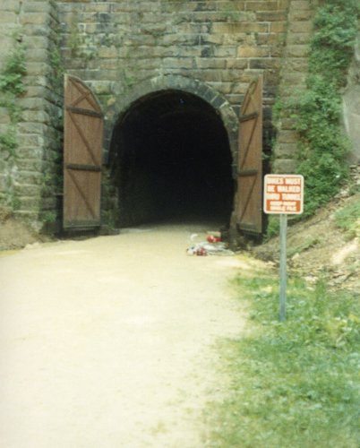
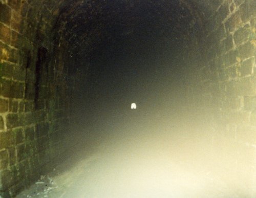 Two pictures of the tunnels on the Sparta to Elroy Trail; the first is tunnel number one and the second is the best I could do to get a shot of 'there is light at the end of tunnel number three'.
17 Jul: Elroy to Portage
Roads: CountyO, CountyK, City Streets & CountyT
Distance: 63.8 miles
Camp: Portage High School
 Two different round barns near Portage,WI.
18 Jul: Portage to Beaver Dam
Roads: Currie Rd, Fox River Road, Grouse Dr, 12th AV, County F, 14th, Gem, County B, County H, WI44, County X, County U, County S, County Q, County SS, County E, Marshview Rd, County W & County A
Distance: 76.0 miles
Camp: Beaver Dam High School-rain
Another day with a very complicated route that was only possible by 'following the yellow arrows'. I also remember that there were two bicycles stolen from the camp during the night, they were owned by weekly riders but it gave us cross-country riders something else to think about. Riding across the USA is not all that simple!
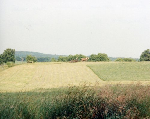
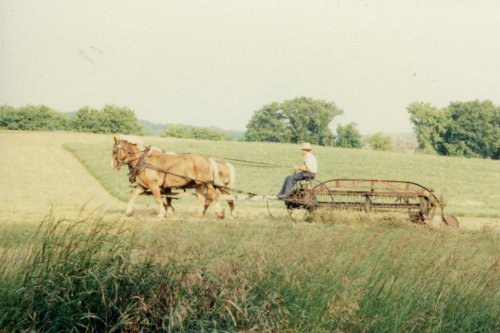
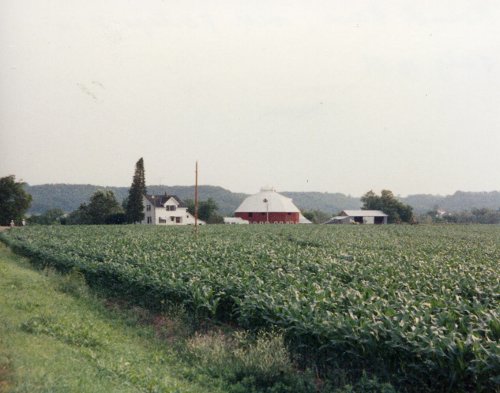
 The first real 'hills' that we have seen since Big Timber, MT; these are between Portage and Beaver Dam, WI. Thee pictures of the Amish near Kingston, WI. The first two are of a farmer cutting hay and the third is a buggy, probably going to town to shop.
19 Jul: Beaver Dam to Plymouth
Roads: Prospect Rd, County E, County TW, County Y, Allen Rd, County D, Beaver Dam Rd, Kettle Moraine Dr, County F & County AE.
Distance: 76.5 miles
Camp: Plymouth High School-rain
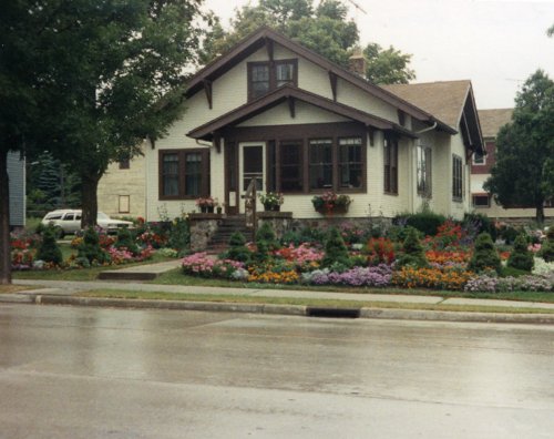 A beautiful house and yard full of flowers in Plymouth, WI. The 'little 'ol lady' owner saw me taking pictures and had to give me the 15 minute tour of her garden and listen to my tale of riding across the country.
20 Jul: Plymouth to Kewaunee/Ludington
Roads: County E, County A, WI52, Country A, Lakeshore Dr & City Streets
Distance: 78.6 miles
Camp: Ludington High School-light rain
Once again it was best to just follow the yellow arrows because today we had to be in Kewaunee by 2:30 PM to catch the Kewaunee to Ludington Ferry across Lake Michigan. For some of the riders, that we called the late dogs, this was a rude shock to their system - get up early and ride in the morning?
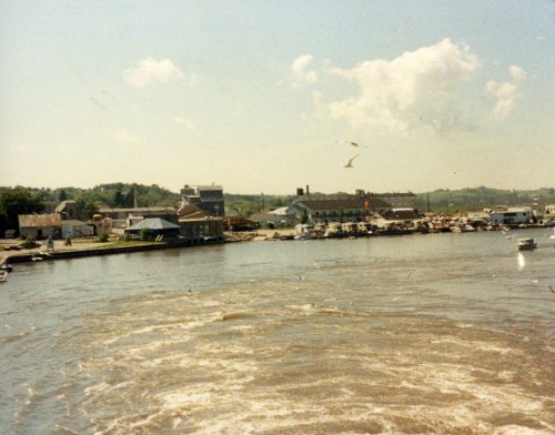
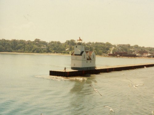 Two pictures from the ferry as we left Kewaunee, WI for Ludington, MI across lake Michigan.
21 Jul: Ludington
Roads: None
Distance: None
Camp: Ludington High School
Week 8: Michigan 
Total distance: 401.0 miles
Week 8 Route
The brochure for week 8 had a planned first stop in Muskegon but we went to Whitehall, our other stops were as shown in the brochure. I have shown no Roads taken for this week, the route sheets that we were given were copies of maps that were impossible to read - the entire week was 'follow the yellow arrows' on the road surface. However, the general route stayed as close to Lake Michigan as roads would allow until we got to Three Oaks then secondary roads, when available, due east to Morenci.
22 Jul: Ludington to Whitehall
Distance: 65.2 miles
Camp: Whitehall High School -rain
23 Jul: Whitehall to Holland
Distance: 75.6 miles
Camp: Holland Junior High School -light rain
 A couple of shots in Grand Haven.
24 Jul: Holland to South Haven
Distance: 43.3 miles
Camp: Mohr High School
25 Jul: South Haven to Three Oaks -light rain
Distance: 55.0 miles
Camp: River Valley High School
26 Jul: Three Oaks to Sturgis
Distance: 87.0 miles
Camp: Sturgis High School
27 Jul: Sturgis to Morenci
Distance:74.9 miles
Camp: Morenci High School
 Two pictures of an Amish dairy farm that was selling cookies and pies; taking advantage of the many hungry cyclist riding right past their front door. They had no electricity for the house but they did have electric milking machines and they also had a cell phone for their dairy business; they were a bit more flexible in their beliefs than some Amish.
28 Jul: Morenci
Distance: None
Camp: Morenci High School
 This camp in Morenci is what most of our camps looked like, excluding the early morning ground fog.
Week 9: Ohio 
Total distance: 431.1 miles
Week 9 Route
29 Jul: Morenci to Ottawa
Roads: Gorham St, Cr19, CrT, Cr20, CrL, Cr19, CrL, Cr17D, CrZ, Cr18, CrJ, Cr19,CrB, Cr16, CrD, Cr15, CrE, OH108, OH613, Road13, RoadG, Road11 & OH15 (Note: Cr=County Road: Road=County or Township)
Distance: 63.7 miles
Camp: Ottawa-Glandorf High School
30 Jul: Ottawa to Sidney
Roads: US224, OH694, RoadK, Road14J, US224, Road14, RoadS, Road16S, OH189, Road17S, Old OH12, Wapak Rd, Ridge Rd, Defiance Trail, Allentown Rd, Monfort Rd, Kossuth-Amanda Rd, OH66, Cr66A, OH66, OH362, E Park St/Dawson Rd, Cisco Rd, Kuther Rd, Cr26/Fair Rd, Cr29 & Johnston Rd (Note: I could not follow the map directions given for this day using MapQuest so I have made some modifications. When riding in Ohio we just followed the yellow arrows because the directions were so complex.)
Distance: 92.2 miles
Camp: Fairlawn High School -rain
The brochure indicated that the camp today was in Sidney, OH and we did pass through there but the camp was about 5 miles to the southeast of Sidney.
31 Jul: Sidney to Richwood
Roads: Johnston Rd, Johnston-Slagle Rd, Johnston Rd, Dormire Rd, Tawawa Maplewood Rd, Deam Rd, Cr4, Shanley Rd, Rosewood-Quincy Rd, Carysville Rd, Snapp Rd (begin Cardinal Trail), OH29, Nine Mile Rd, Wesley Chapel Rd, OH245, US68, Cr5, Cr2, Road131, Cr8, OH142, Cr124, Cr26/311, OH31, Turner Rd, McPeck Rd, Boundry Rd, Lemasters Rd, Mulvane Rd & OH37.
Distance: 62.7 miles
Camp: North Union High School -light rain
1 Aug: Richwood to Butler
Roads: OH37, Boundry Rd, Sandusky-Prospect Rd (leave Cardinal Trail), Water St, Prospect-Norton Rd, Almendinger Rd, Waldo-Western Rd, Waldo-Fulton Rd, Hoke Rd, Prospect-Mt Vernon Rd, OH26, Prospect-Mt Vernon Rd, Cr170, OH229 (rejoin Cardinal Trail), Cr19/Sparta Rd, OH95, Old Mansfield Rd, Hamilton Rd, Garber Rd, Stoffer Rd, Road 345/Gatton Rocks Rd & OH97 (Note: I have added a few short connecting roads that the route sheet did not show; again the best way to have ridden this route was by following the yellow arrows).
Distance: 65.6 miles
Camp: Clear Fork Junior High
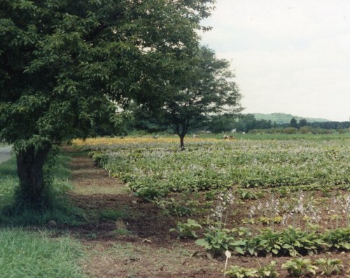 We entered rolling hills once again between Richwood and Butler. This is a large flower bulb farm near Butler.
2 Aug: Butler to Canal Fulton
Roads: (Cardinal Trail all day) OH95, OH603, Cr30A, N. Elyria Rd, W. Smithville-Western Rd, N. Elyria Rd, Pleasant Home Rd, Apple Creek Rd, Fulton Rd, Cherry St/Manchester Av & Patterson St.(Note: the brochure gave Canal Fulton as our stop for the day but we stayed at Clay's Park about 3 miles south and the map did not give directions. If you followed the yellow arrows you would have reached it, I have added street directions to Clay's.)
Distance:70.0 miles
Camp: Clay's Park Resort
3 Aug: Canal Fulton to Bessemer, PA
Roads: Patterson St, Manchester Av/Cherry St, Strausser Rd, Lutz Av, Mt Pleasant Rd, Market Av, Smith-Kramer St, William Penn Av, Edison St, Duquette Av, Pontius St/Price St, Greenbower St/ Middleton Rd, Beloit-Snodes Rd, OH165, Springfiled Rd & Calla Rd/PA317. (Note: The stop for the day was to be Bessemer, PA but camp was about 2.5 miles east of the town.)
Distance: 76.9 miles
Camp: Mohawk Area Schools
4 Aug: Bessemer, PA
Roads: None
Distance: None
Camp: Mohawk Area Schools -rain
Week 10: Pennsylvania 
Total distance: 22.0 miles
Week 10 Route
5 Aug: Bessemer to Near Koppel
Roads: PA317, Paden Rd, Moravia Rd, Galillee/Eastbrook Rd, Wampum Mount Air Rd, Glenkirk Rd/Shenango Rd, OH351 & PA65 then **CRASH***
Distance: 22.0 miles
Camp: Buttercup Campground
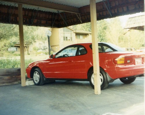
I'm not sure that I crashed on PA65 it may have been on PA588 but was around 6 miles from Koppel where I had stopped for breakfast. It was raining and/or misting lightly and I had crested a steep hill and was gathering speed on the downslope when I touched the brakes and immediately lost control in a skid that took me off the right side of the road into a ditch and embankment where I fell heavily on my left side. I was wearing a Giro 'beer cooler' helmet, with a fabric cover, that broke into three pieces but did its job of protecting my head. My left shoulder was covered with road rash that was full of dirt but the worse damage was to the tendon that connects the thigh muscle to the hip; this was badly torn or bruised and the doctor at New Castle emergency room said that only time was going to heal it (maybe 1-2 weeks). A Cycle America staff car had picked me up soon after the crash and took me to New Castle and then to our camp near Butler.
Epilogue: I could not raise my left leg without a lot of pain therefore I could barely walk and bicycle riding was out of the question so I rode a 'sag wagon' for two days until State College, PA. At State College, Jennette, the girlfriend and sag driver for our video guy Tim, was going to return to Bend, OR with a stop near Chicago to participate in a Triathlon. She was trying to get a high finish position and therefore qualify for the Hawaii Iron Man Triathlon. I talked to her about sharing expenses on her trip back to Bend and then she drove me to an Amtrak stop in Chemult, OR. I was back riding again after about 3 weeks with no permanent damage done and still had the desire to ride and also had the knowledge that I could ride across the country baring mishaps. I also became a 'real' American once again and bought a car, I had a company car until I quit my job so was car-less from 1 April until I got back from the cross country ride. I kept the Toyota Celica that I bought until I went to Bulgaria in 1996.