Western Tour
w/ Bike America
Flagstaff, AZ to San Francisco, CA
8 June - 25 August, 1991
4,828 Miles
Total Tour

I was not working at a job that I could not leave when I felt like it and some of the OFC (Old Farts Club) Members encouraged me to join them. So I made arrangements with a cousin in Las Vegas to keep my car there during the summer and drive me to Flagstaff. I then drove to her place on June 7th, stayed the night and then she took me to the Flagstaff Fairgrounds, our first camp, on the 8th.
For this re-constructed journal I do have some journal notes, the weekly maps from Bike America and some pictures (but no captions). I'll do what I can with this information and once again I'll do it in the same fashion as Bike America did the tour - by state.
Week 1: Arizona
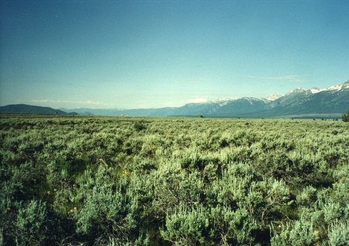
 Total distance: 413 miles
Week 1 Route
The Arizona Tour, Week 1, was shown on the Bike America brochure as ending in Springdale, UT on June 14th and Week 2 starting in Orderville, UT on June 16th. This meant that our normal rest day, the 15th, was actually a riding day to get from Springdale to Orderville and it also meant that we rode for 11 days before we got a rest day in Cortez, CO at the end of Week 2 (maybe that is why I have always thought the Utah week was one of the hardest?).
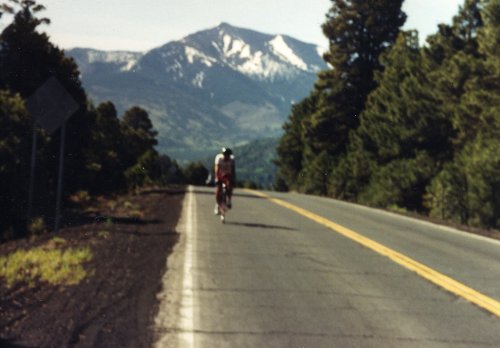
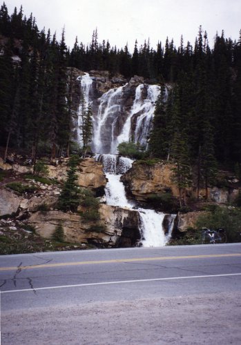
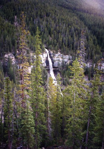
9 Jun: Flagstaff to Tusayan
Roads: US180
Distance: 79 miles
Camp: Campers Village
It was great first day, I rode with a few people that I had not seen since last year on the Cross Country Tour and enjoyed being back on the road.
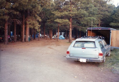
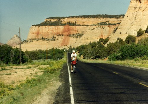
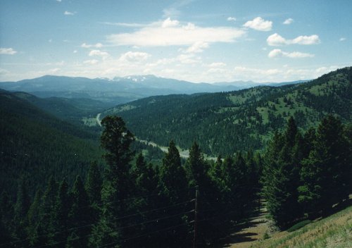
 Our camp at the Flagstaff Fairgrounds, one of many nice campgrounds that we had on this Western Tour. On the road again, the first day from Flagstaff to the Grand Canyon. The beginning of a trip is always exciting and we had a perfect day for this one versus the rain in Washington last year.
10 Jun: Tusayan
Roads: Grand Canyon Park Roads
Distance: 27 miles
Camp: Campers Village
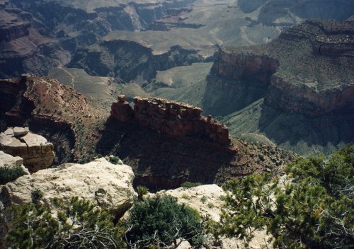
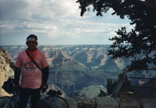
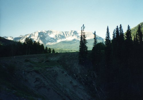
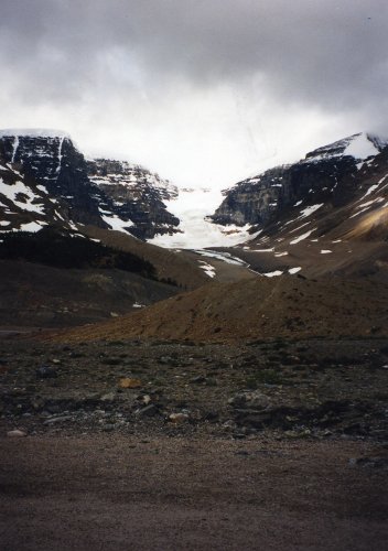
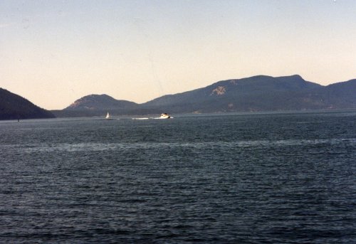
We were on our own today; I rode to Hermits Rest at the west end of the Park and took pictures along the way. I then broke a chain in Grand Canyon Village on the way back to camp but had good luck with hitching a ride in the first pick-up truck that I flag down. I got the chain replaced at a shop in Grand Canyon Village for less than what my shop at home would have charged me!
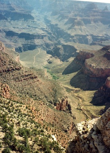
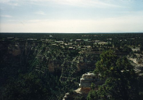
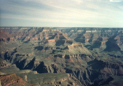
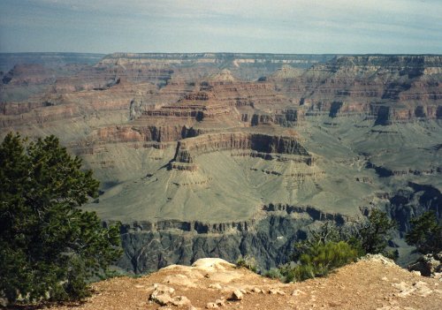
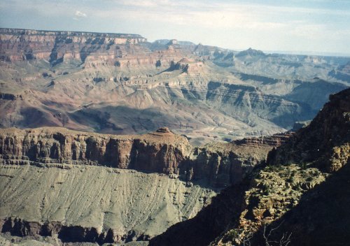
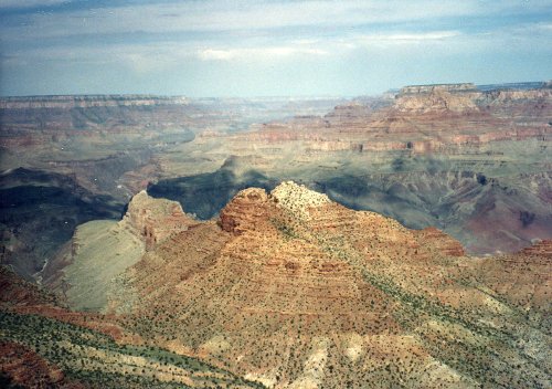
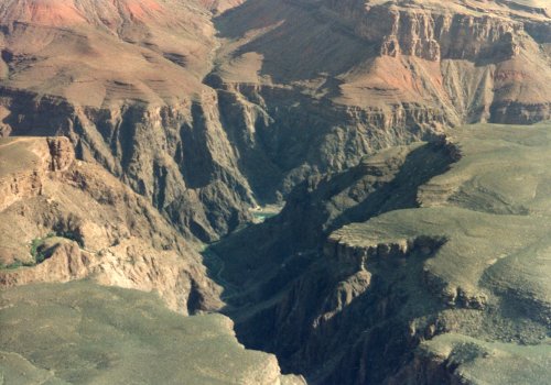 The first two pictures were taken from a location west of Grand Canyon Village and the first shows Bright Angel Trail. During Easter Vacation (maybe 1963), while I was at the University of Arizona, three of us hiked down the Kaibab Trail, overnight at Bright Angel Campground, overnight at Indian Garden Campground and then up the trail that you see. The second one shows the Bright Angel Lodge Complex on the canyon rim. Then two pictures of the Grand Canyon from near Hermits Rest (I think). In the second one you can see just a bit of the Colorado River in the center of the picture.
11 Jun: Tusayan to Tuba City
Roads: AZ64, US89 & US160
Distance: 85 miles
Camp: Tuba City High School
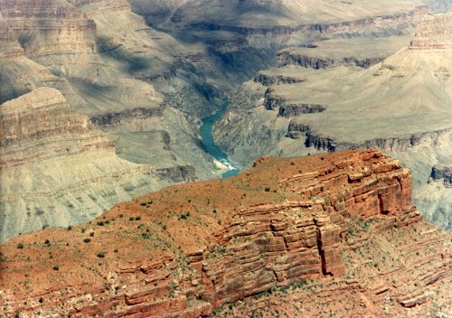
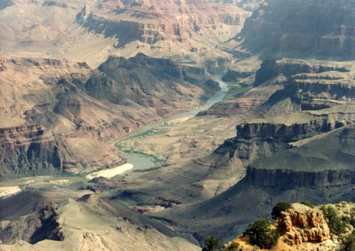
I rode alone most of this hot day with some early morning stops to get pictures of the eastern part of the Grand Canyon.

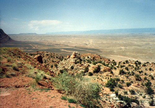
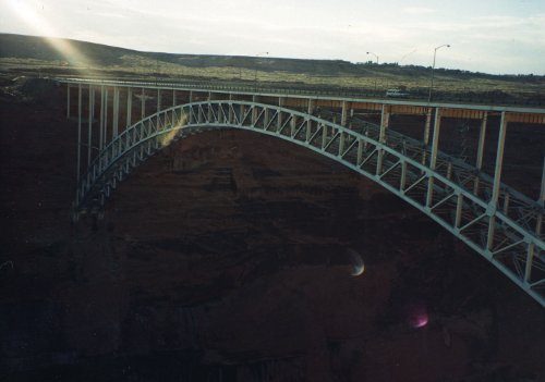
12 Jun: Tuba City to Page
Roads: US160 & US89
Distance: 78 miles
Camp: Page High School
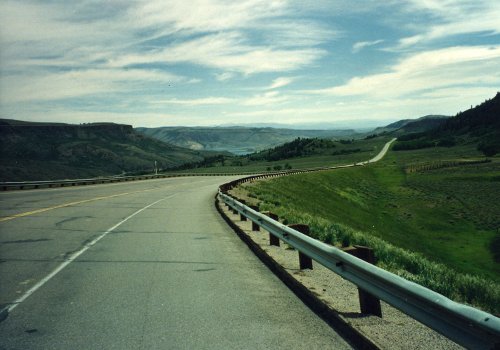
This was another hot day but I was through by noon so missed a lot of the heat. There was a rather steep 3 mile climb up to the mesa and then a very nice 20 mile downhill into Page; a lot of smiling faces after the climb was over with.
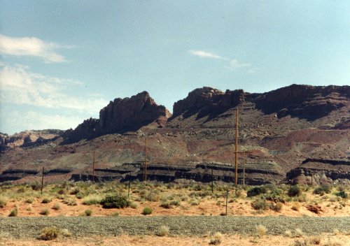
13 Jun: Page to Knab, UT
Roads: US89
Distance: 74 miles
Camp: Knab Middle School
We had a BAD headwind almost all day. I let a young girl sit on my wheel for much of the distance but she said for me to go on that she could not hold the pace any longer. I then sat on the wheel of one of the staff riders for the last 5 miles into Knab and was glad to have her pull.
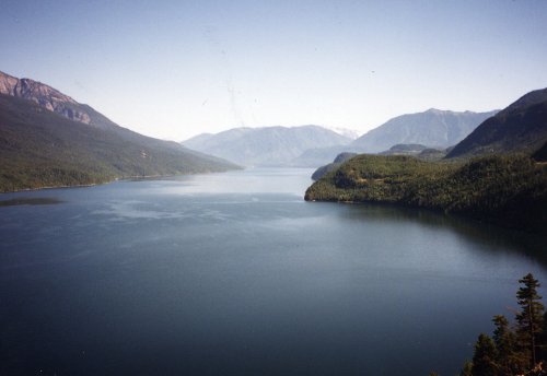
14 Jun: Knab to Springdale
Roads: US89 & UT9
Distance: 40 miles
Camp: Springdale City Park
A shorter day with some rolling hills, 3 stiff climbs and a long downhill through Zion National Park to camp.
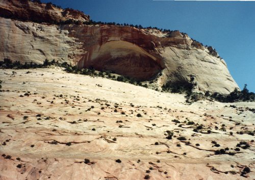
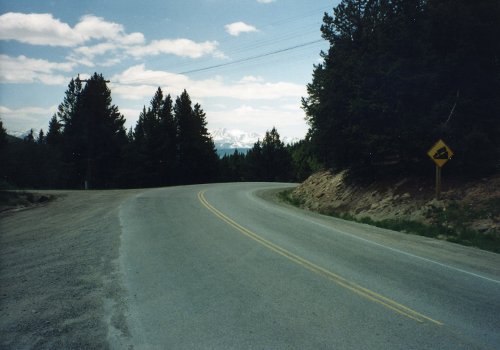
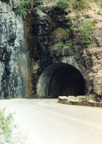
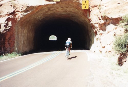 Two pictures along the way to Zion in Utah. The first shows a rider entering one of the short tunnels on the east side of Zion Park, the long tunnel is not open to cyclist without an escort.
15 Jun: Springdale to Orderville
Roads: UT9 & US89
Distance: 30 miles
Camp: Some school
We rode back on UT9 the way that we had come in yesterday which meant climbing up that long downhill. We also went through a long tunnel that you are not allowed to ride on a bicycle without an escort. Yesterday I was waiting on the east end of the tunnel with two other riders and a pick-up stopped and loaded us all in. This morning there were about six of us waiting and a truck stopped and said that he would provide lights for us and escort us through so we road it - it is downhill going east so it was a fun ride!
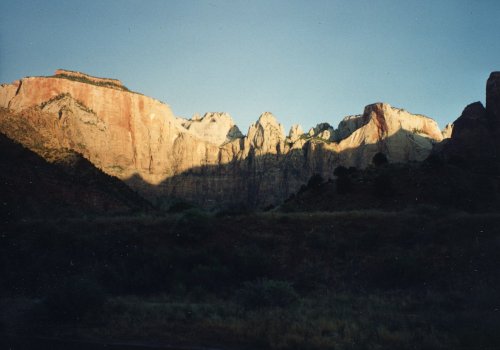
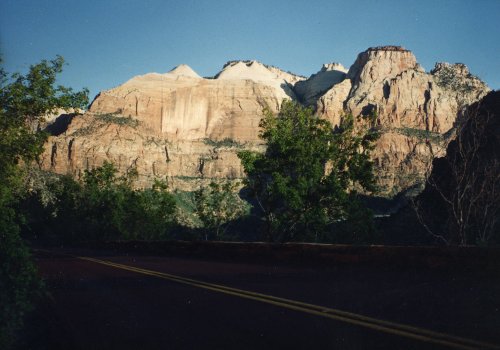
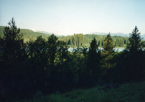
 Two pictures of the mountains in Zion Park in the early morning. The road east of Zion Park and a typical view of Long Valley near Orderville that goes up to the turn off for Bryce Canyon.
Week 2: Utah
 Total distance: 450 miles
Week 2 Route
Roads: US89 & UT12
Distance: 62 miles
Camp: Ruby's Inn Campground
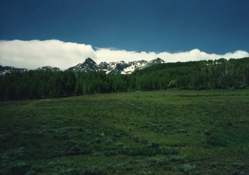
There was a 17 mile, 2000 feet, climb from Orderville to Tod's at Long Valley Junction (UT14) and then another 17 mile and 2000 feet climb from US89 to Bryce Canyon. I didn't ride all the way through the Park, only to the first group of hoodoos for a few pictures.
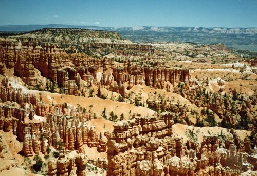

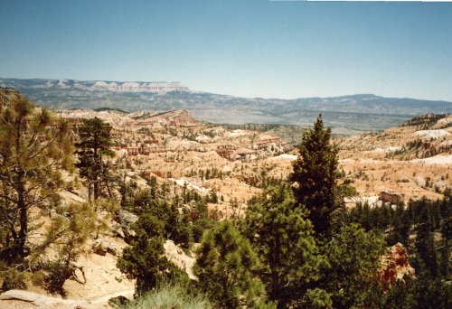
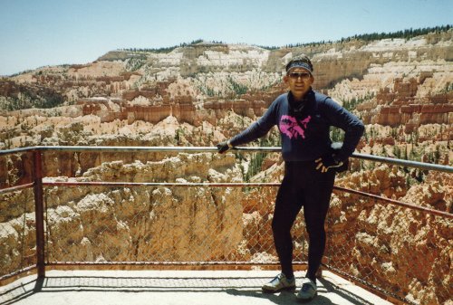 Bryce Canyon with me posing in front of the Bryce Canyon hoodoos.
17 Jun: Bryce Canyon to Escalante
Roads: UT12
Distance: 52 miles
Camp: Some school
There was a stiff climb from Paria River to a summit at 7,400 feet but had a good downhill from Ruby's Inn to Paria River and then from the summit to Escalante. The big event of the day however took place in front of a sheep pen on the main street in Escalante after the ride was over. I was officially inducted with great pomp and circumstance into the OFC. Members are usually designated as being OFC#xx depending on the sequence of their becoming a member however I'm not fully qualified because I have not yet attained the age requirement. Therefore, my designation is OFC-U#3 where the 'U'indicates that I'm underage and the 3 means that I'm the third underage member accepted.
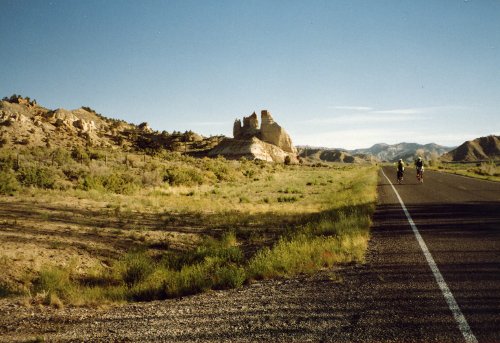
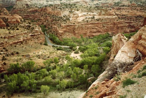
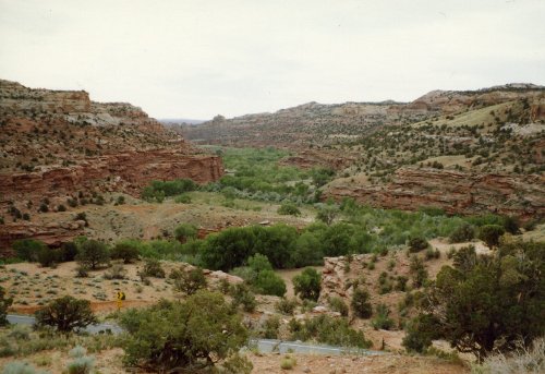
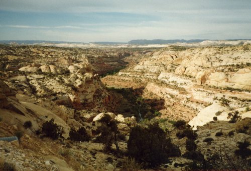
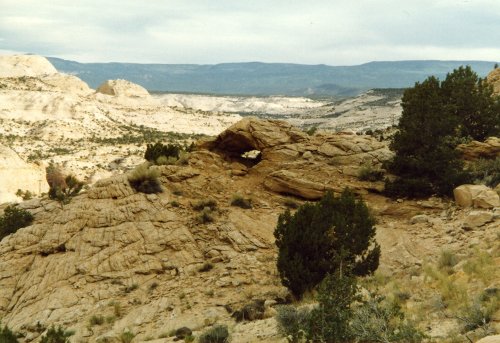
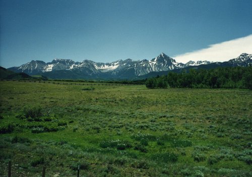
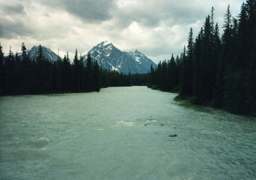
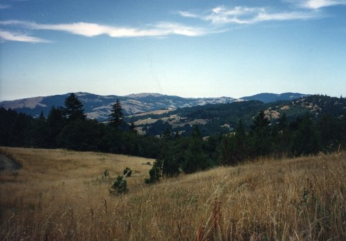
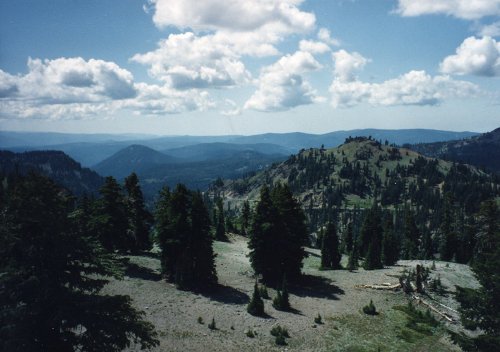
 The road to Escalante with Grand Staircase Escalante National Monument to the left side of the road (it is a huge land area that has the spectacular Paria River canyons, but the size was determined more by how much land could be withdrawn from oil drilling than anything else.) The next three pictures are of the Escalante Canyons and Calf Creek area north of Escalante, UT as is the one on the left. The two directly above are looking south/southwest to Escalante and Bryce Canyon where we have ridden from.
18 Jun: Escalante to Bicknell
Roads: UT12 & UT24
Distance: 71 miles
Camp: Some school
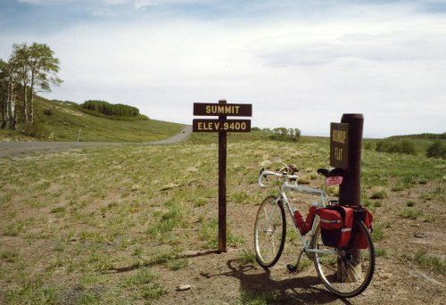
Today was a very tough ride with over 7,000 feet of climbing and I was wore out when I got in today. The summit of all that climbing was at 9,400 feet then a fast downhill on which Ray (one of the original 1989 OFCers) crashed at high speed with some bad road rash and probably pains in places he didn't know he had.
19 Jun: Bicknell to Hites Crossing
Roads: UT24 & UT95
Distance: 106 miles (first Century)
Camp: A bare parking lot by the Colorado River
I just thought yesterday was tough. Today we had and easy time of it for about the first 50 miles to Hanksville but then turned south to a gradual uphill and into a headwind. Then when we thought it couldn't get worse it got hoter and there were two steep climbs at the end of the day. There were a lot of people quit and take the 'sag wagon' today, there was a point where I stopped to rest that I would have probably done the same if one had come by.
20 Jun: Hites Crossing to Blanding
Roads: UT95 & US191
Distance: 78 miles
Camp: Another school
A lot of uphill again today with 3 big climbs in the last 10 miles. My feet are very sore because of the amount of climbing that we have done.
21 Jun: Blanding to Cortez, CO
Roads: US191 & US491
Distance: 81 miles
Camp: Cortez High School (I think)
There was a long steep climb out of Monticello with a rolling downhill and headwinds into Cortez; not as bad as the previous three days. I had a GREAT dinner at Nero's Restaurant!
22 Jun: Cortez, CO
Roads: None
Distance: None
Camp: Cortez High School
A really good breakfast at Peppe's. Today was 'duff' day and I got my bike cleaned up and laundry done. Also, caught a van ride to Mesa Verde where I spent about 4 hours doing the tourist thing.
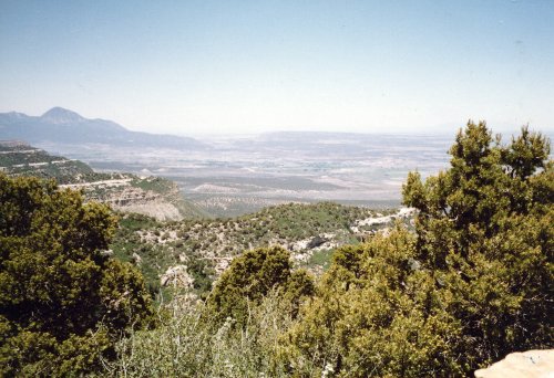
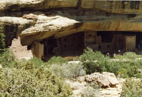
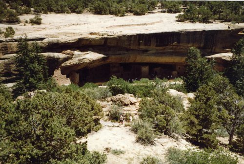
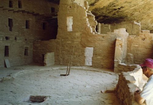
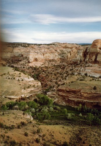
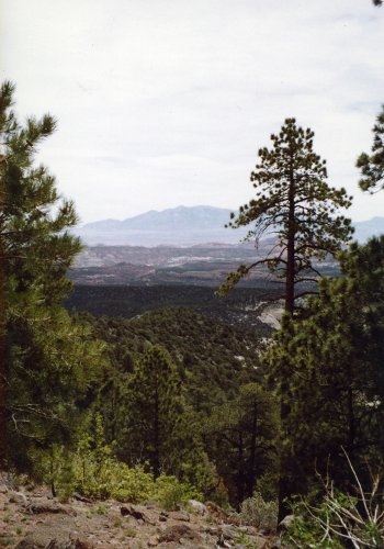
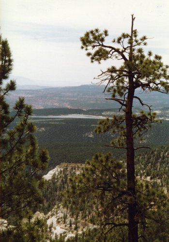
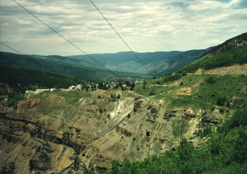
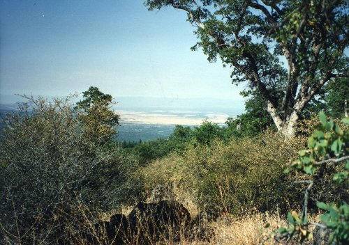
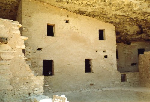 This is from the top of Mesa Verde looking down toward Cortez (I think). Two pictures of some of the cliff houses from the top of the mesa. Then two pictures of the same cliff houses from close up. In the first one you can see two openings in the courtyard that lead down into the kiva. The last picture shows how well the cliff has preserved the houses.
Week 3: Colorado
 Total distance: 439 miles
Week 3 Route
Roads: US160 & CO145
Distance: 49 miles
Camp: A field or maybe town park
Today we went up the Deloras River valley to Rico rather than Telluride as planned. There was a Bluegrass Festival in Telluride that had taken over all the camping facilities. It was a very pretty ride, cool and startling blue sky all the way with about 2,600 feet of gradual climbing. Tomorrow will be 90 miles with two passes but that might be easier than today's planned 80 miles.
24 Jun: Rico to Montrose
Roads: CO145, CO62 & US550
Distance: 86 miles
Camp: Montrose High School
The two passes today were Lizard Head Pass at 10, 250 feet and Dallas Divide at 8,900 feet. I think the stop in Rico made for a better ride than Telluride; we would have been doing Lizard Head later in the day yesterday rather than early today. The worse thing about today was the heavy traffic on CO145 from the Festival, the road was narrow, little shoulder and almost constant traffic passing. The temperature this morning in Rico was below freezing, water bottles left on the bike were frozen, but it warmed up a lot from Ridgeway to Montrose. All in all , a good day!
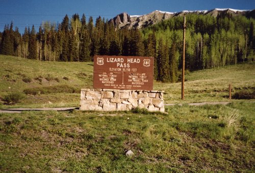
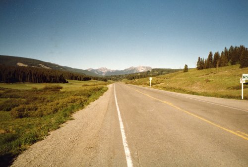
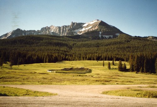
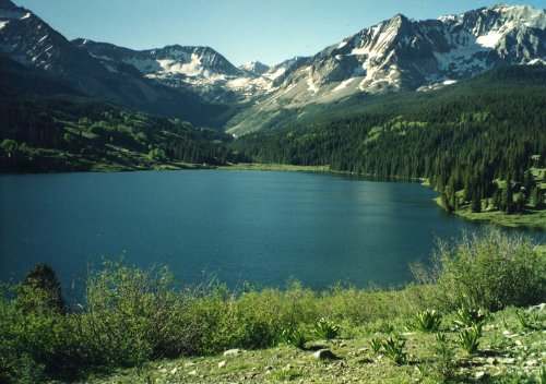
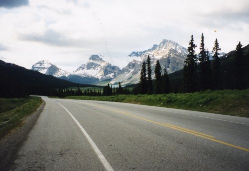
 The first seven pictures start with Lizard Head Pass and then were taken along the way as I rode north until the turn off to Telluride. This is what the Rocky Mountains have always looked like in my minds eye. The last picture is US50 on the eastern side of Blue Mesa Summit going toward Gunnison.
25 Jun: Montrose to Gunnison
Roads: US50
Distance: 64 miles
Camp: Western Colorado State College
We had two tough climbs today; Cerro Summit, near Cimarron, and Blue Mesa Summit by Blue Mesa Reservoir for a total of over 5,000 feet. The last 26 miles were generally downhill which helped a lot. I had some great linguine in a good little bar/restaurant.
26 Jun: Gunnison to Buena Vista
Roads: US50 & US285
Distance: 82 miles
Camp: Buena Vista High School
We had only one pass today but it was Monarch Pass at 11,312 feet with some difficult crosswinds on both sides of the pass. It took me 1.5 hours to climb the final 7 miles to the summit, our first crossing of the Continental Divide. The OFC Members are of the general opinion that they would not do this tour again; it has been very hard with 1/2 to 1/3 of all the participants 'saging' every day.
27 Jun: Buena Vista to Minturn
Roads: US24
Distance: 64 miles
Camp: Some school
Minturn, CO is a suburb of Vail, CO with bars/restaurants opening at 5 or 6 PM that have snooty and uncooperative serving staff - not my idea of a good bicycling tour stop but distance dictates. It was a great ride today, the first one since Arizona that I have not been in my small chain-ring. I felt good all day which is a big improvement over the past few days. That was with our second Continental Divide crossing at Tennessee Pass, elevation of 10,424 feet.

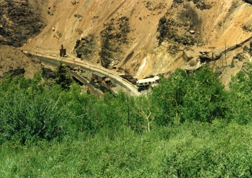 Tennessee Pass is near Leadville, CO, which is the highest incorporated city in the USA at 10,152 feet. Second picture is start of the downhill from the summit of Tennessee Pass going north. This was our second Continental Divide crossing of the tour. Th mining operation in the three pictures is just off US24 between Tennessee Pass and Minturn, CO. I found it interesting and speculated on what it was like in the winter.
28 Jun: Minturn to Steamboat Springs
Roads: US24, US6, CO131 & US40
Distance: 94 miles
Camp: Private Campground west of Steamboat Springs; bus service to town
There were two 9 mile long climbs today from Wolcott, US6 & CO131, and from McCoy; with a nice downhill after about the 50 mile mark.
29 Jun: Steamboat Springs
Roads: None
Distance: None
Camp: Same as on 28 Jun
A 'duff' day; clean bike, rotate tires, eat three square meals and have an OFC Meeting (this means to sit around, drink beer and tell lies).
Week 4: Wyoming
 Total distance: 551 miles
Week 4 Route
Roads: US40, CO13 & WY789
Distance: 79 miles
Camp: Baggs High School
We had an easy downhill of about 40 miles to Craig, CO then some rolling hills with crosswind that occasionally become tailwinds. There were only two modest climbs during the day and I was in my middle or big chain-ring all day. A good day!
1 Jul: Baggs to Wamsutter
Roads: WY789 & I-80
Distance: 65 miles
Camp: Desert School
We had another easy day. It was generally uphill, but gradually, to out third Continental Divide crossing at 7,004 feet. The last 14 miles into a pretty nice school camp was on the Interstate. Wamsutter is an oil drilling and oil service town that seems OK in spite of or because of its isolation (but almost everyplace in WY is isolated).
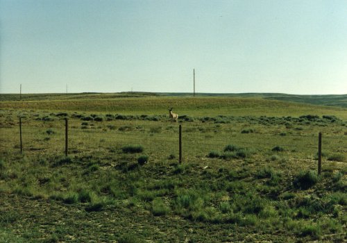 Two pictures of southern Wyoming. The first is from WY789 on the way to Wamsutter very early in the morning. I think the second was taken from I-80 of an antelope, just one of many that we saw in the southern part of the state.
2 Jul: Wamsutter to Rock Springs
Roads: I-80 & City Streets
Distance: 69 miles
Camp: East Junior High School
We rode rolling hills on the Interstate shoulder that had very little trash and was nice and smooth. I averaged 16 MPH for the day and was cruising in my middle chain-ring; finished 2nd of all the riders today and left at 6:05 AM. Crossed the Continental Divide for the fourth time just west of Wamsutter at 6,930 feet. So it was a good day! Then had a wonderful meal at the Park Hotel.
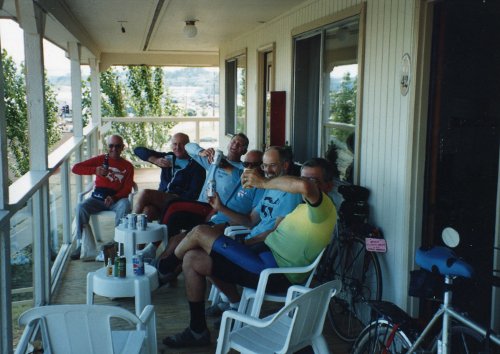
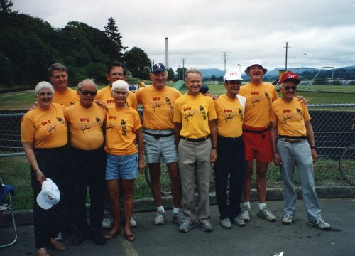
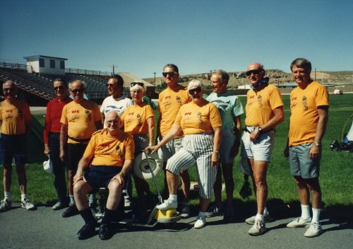 A group photo of the OFC at Rock Springs; the football field was one of many that served as our campgrounds.
3 Jul: Rock Springs to Pinedale
Roads: US191
Distance: 100 miles (second Century)
Camp: Pinedale KOA
It was a good Century ride where I felt good at the end. Mostly rolling hills with one long climb at the beginning. There were some winds from about the mid-point but could maintain a 11 MPG average pace so they were not too bad. The tour director set up free ice cream at Farson so it was a good day!
4 Jul: Pinedale to Jackson
Roads: US191 & US191/89/26
Distance: 77 miles
Camp: Junior High School
There was a long climb early in the day and then a lot of downhill through a canyon to Jackson; fairly easy day. Jackson is very much a tourist town and it was FULL. I got in early enough to do laundry, have lunch and visit the Million $ Bar - fireworks for the 4th woke me up.
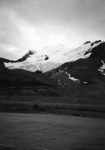
5 Jul: Jackson to Flagg Ranch
Roads: US191/89/26, US26 & US191/287/89
Distance: 81 miles
Camp: Flagg Ranch just south of Yellowstone Park
There were views of the Tetons all day as we rode north. I made a wrong turn and rode about 25 miles extra; went toward Dubois until the road stated to climb and then looked at the map. I was riding with Wally on my wheel and I asked him why he didn't say anything about me going the wrong way. His answer 'well I thought you might have made a wrong turn, but we were making GOOD TIME.' Most of the OFC Members are 'sagging' through Yellowstone tomorrow, our normal rest day, because they don't want to fight the traffic.
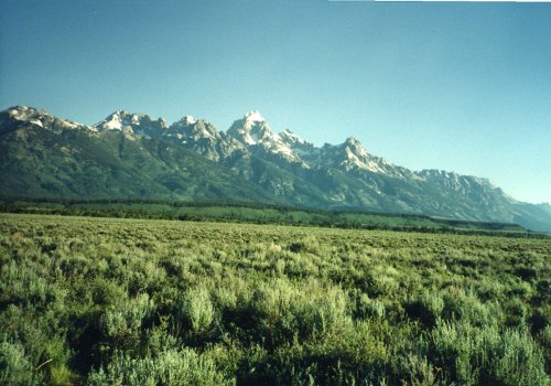
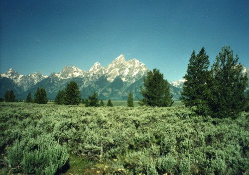
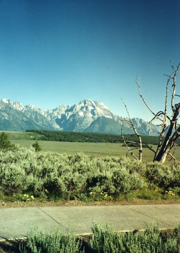
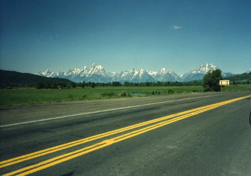 Five pictures of the Teton Range in the Grand Teton National Park.
6 Jul: Flagg Ranch to West Yellowstone
Roads: US191/89 & US191 Through Yellowstone
Distance: 80 miles
Camp: Lionshead Campground
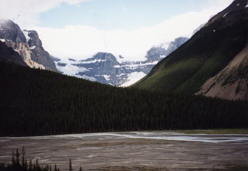
It was about 2 miles to Yellowstone Park entrance and maybe 40 miles to the Old Faithful Complex. The southern part of the Park is just as badly burned as what I saw in the north last year. I did what amounted to a 73 mile time trial through the Park with an early start to avoid the traffic ( but I didn't find it any worse than from Telluride to Montrose.) There were three more Continental Divide crossings in the Park: 7,988 feet near Thumb area, then 8,391 feet Craig Pass (then good downhill) and finally a summit at 8,262 feet (this now makes 7 crossings and we are on the Atlantic side once again).
Week 5: Montana
 Total distance: 449 miles
Week 5 Route
7 Jul: West Yellowstone to Ennis
Roads: US20, ID87/MT87 & US287
Distance: 65 miles
Camp: Ennis High School
It was very cold and windy as we crossed two more Continental Divide passes; Targhee at 7,072 feet and Raynolds at 6,824. These passes were also the border between WY/ID and ID/MT respectively so we crossed through a very small part of ID today and were in 3 states. It was generally downhill but into a cold headwind. There was a great western music jam session in a bar in town from 2-5 PM and I had a good time. A nice day - 'no bitchin'.
8 Jul: Ennis to Townsend
Roads: US287
Distance: 76 miles
Camp: Townsend High School
This section is much easier from south to north! I remember the ride from north to south as being a tough one last year. I had a great Italian dinner at the north end of downtown; all I could eat.
9 Jul: Townsend to Lincoln
Roads: US287/12, Helena City Streets, MT279 & MT200
Distance: 90 miles
Camp: Lincoln High School
A tough day! I had two flats; fixed one of the tubes at the Aid Station stop. I also broke a rear axle that caused the rear wheel to rub against the frame. I was lucky that OFCU#1, Sharon, came by in her van and picked me up and took me back to Helena, MT to a bike shop where I got it fixed. She then brought me back to the same place she picked me up and I continued the ride (we did not know it at the time but this gave me a 'no sag' completion of the entire tour). I think I was the last one to complete the route today and the 'sweeps' were concerned but I'm proud that I stuck with it. Crossed the Continental Divide at Flesher Pass, 6,131 feet, for the 10th time (this was our first crossing last year). A good dinner at the Wilderness Bar & Grill.
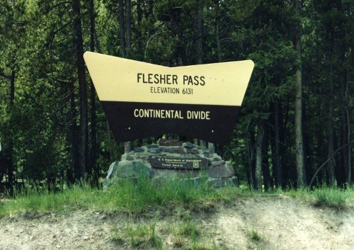
 Flesher Pass, our 10th Continental Divide crossing this tour, from east to west this time; it was our only crossing last year from west to east. This is the west slope of Flesher Pass.
10 Jul: Lincoln to Seeley Lake
Roads: MT200& MT83
Distance: 54 miles
Camp: Seeley Lake High School
A fast OFC time trial today to the Aid Station stop averaging 16.1 MPH for the 33 miles. We then slowed up for the rest of the route but still got into camp by 11:00 AM. Had tent set up, showered, walked to town and had a good lunch by noon - it was a good day!
 This is one of the few views you can get of Seeley Lake from MT83; it lies hidden behind a lot of pine trees from the town of the same name.
11 Jul: Seeley Lake to Big Fork
Roads: MT83 & MT35
Distance: 74 miles
Camp: Big Fork High School
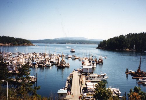
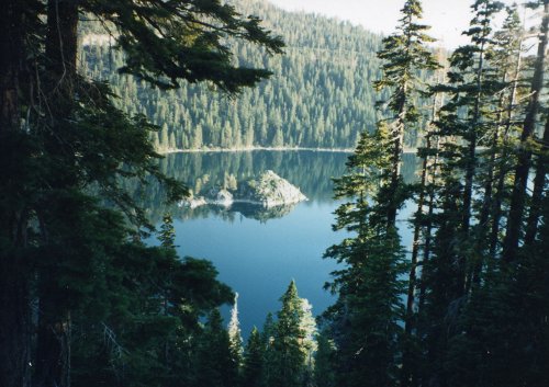
A relatively easy day. The view of Flathead Lake from the bowling alley is spectacular.
12 Jul: Big Fork to West Glacier
Roads: MT35 & US2
Distance: 38 miles
Camp: West Glacier KOA
An easy ride! The portion from the Bad Rock Canyon Historical sign to the helicopter camp was much easier than what I remember from a year ago (just maybe I'm in much better shape). A great meal at the restaurant/showers sign about 6 miles west of West Glacier. I walked into West Glacier and back in the afternoon; camp is so-so with good showers but about 1 - miles from town.
13 Jul: West Glacier to St Mary
Roads: Going to the Sun Road through Glacier Park
Distance: 52 miles
Camp: Johnson's Campground
It was a 30 mile gradual climb to Logan Pass our 11th Continental Divide crossing at 6,680 feet. The last 12 miles were fairly steep but a consistent grade, just grind it out in the small chain-ring. I got a good picture of a deer up close and saw marmots but didn't get any pictures.
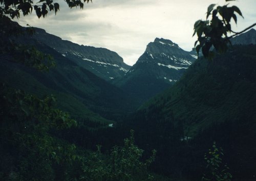
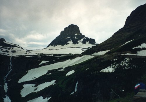
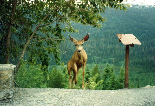
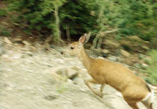
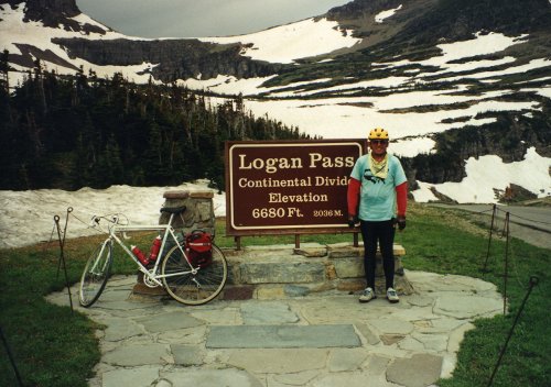
 First row, three pictures of Glacier Park peaks from near Logan Pass. Second row, two pictures of a deer on Going to the Sun Road in Glacier Park. Neither picture is with telephoto lens, the deer was that close! That is me at our 11th Continental Divide crossing, the last one in the United States. I think this is the only tunnel on the Going to the Sun Road, they did a lot of cut and fill but little tunneling.
14 Jul: St Mary to Jasper, Alberta, Canada
Roads: Bus Route; I didn't pay any attention
Distance: None by bicycle
Camp: Whistler's Campground
Today was our usual rest day and it was very welcome after riding for 14 days without one. The rest was not as good as it could have been because we did it on a 12 hour bus ride to Jasper, Alberta with a stop in Calgary to pick up new weekly riders. We didn't get to the campground until 9:00 PM and dinner was at 10:00 PM; and that was only because of the van that OFCU#1 was driving and using as an OFC sag wagon, we were not within walking distance of Jasper.
Week 6: Alberta, Canada
 Total distance: 388 miles
Week 6 Route
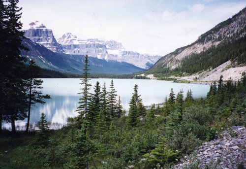
15 Jul: Whistlers Campground to Ranger Creek
Roads: AL93A & AL93
Distance: 44 miles
Camp: Ranger Creek
I rode into Jasper for breakfast and was back in camp by 8:00 AM in time for the 9:00 AM tour meeting. It was then an easy ride on AL93A with a lot of stops along the way to Ranger Creek which was a dry camp that was more aptly described as a gravel pit that was dug during the road construction. Dinner was at a restaurant 3 miles further south that the riders had to ride to and back, the OFC had the good fortune of having OFCU1 and the van for this kind of planning. I saw elk everywhere, even on the streets of Jasper, deer with velvet antlers, marmots and mountain goats at a mineral lick viewpoint about 24 miles south of Jasper.
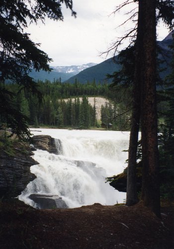
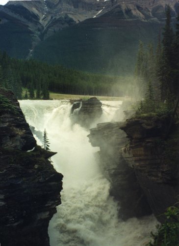
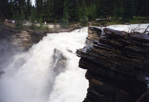
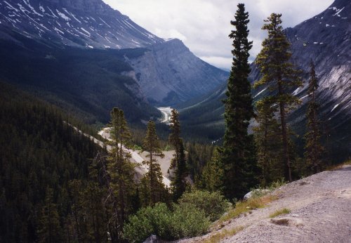
 First row, three pictures of Athabasca Falls. We road through the Athabasca Valley which is the center portion of Jasper National Park. Second row, the Athabasca River which has its headwaters at the Icefield Glaciers. A mountain goat at the mountain goat mineral lick on the banks of the Athabasca about 5 miles south of the Falls and one of two pictures of the mountains bordering the Athabasca Valley in Jasper Park.
16 Jul: Ranger Creek to Waterfowl Lake
Roads: AL93
Distance: 76 miles
Camp: Waterfowl Lake Campground
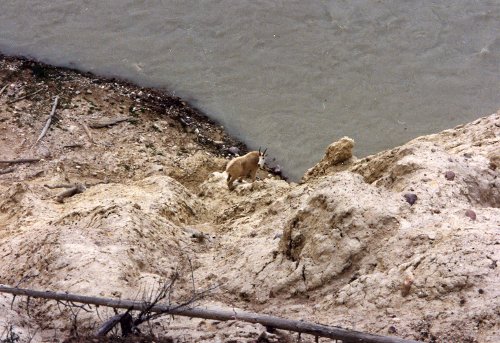
There was a steep climb at about the 30 mile mark to the Columbia Icefield Glaciers and then a good downhill to the junction with AL11 where I stopped for lunch. I saw two rams at the Tangle Creek Maintenance Yard parking lot but it was too steep of a climb to try and get up to them for a picture. I went to dinner with OFCU1, OFCU2 and Harriet for (Sharon's) OFCU1's birthday. There was also a Canadian beer fund established today with OFCU1 put in charge of acquiring same.
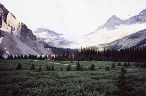
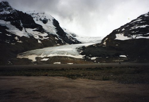 Four pictures of the Columbia Icefield which lies on the border of and within both Jasper Park and Banff Park. I think the last picture is Stutfield Glacier, the first that you can see going south toward the Icefield.
 Tangle Falls comes right down to the main road for a great photo opportunity. Panther Falls in Banff Park about 7 miles south of the Icefield. Waterfowl Lake, our last camp along the Icefield Parkway. Bow Summit, looking south through a glacier carved valley.
17 Jul: Waterfowl Lake to Banff
Roads: AL93 & Canada1
Distance: 84 miles
Camp: Tunnel Mountain Campground Village 1
I did an extra 5 miles to Lake Louise and took pictures of the chalet. I also got pictures of moose and bighorn sheep today both of them quite close to me. The bighorn sheep were under a road overpass near Banff that is salted in the winter, the salt spills down under the overpass and creates an salt lick the the sheep come to. We have had light rains everyday but this afternoon it rained heavy but I was through riding for the day.
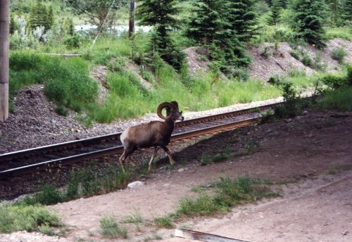
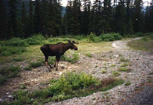
 Two pictures of the mountains that overlook the valley in Banff Park. Two of the many North American big game animals that I saw in Jasper and Banff Parks; the only thing that I missed was a bear which some other riders did see. The chalet at Lake Louise.
18 Jul: Banff to Golden, British Columbia
Roads: Canada1
Distance: 91 miles
Camp: Municipal Campground
A bad day! I had a slow leak flat that I pumped up 4 times before I stopped and patched it. It was cold in the morning, rained mid-day (while I was patching tube), very bad or no road shoulder and then for the last 10 miles we had heavy traffic because of an accident. Crossed the Continental Divide at Kicking Horse Pass, 5,330 feet, for the 12th and last time; we are back on the Pacific side and will stay there for the rest of the tour.
19 Jul: Golden to Revelstoke, British Columbia
Roads: Canada 1
Distance: 93 miles
Camp: Queen Elizabeth Park
Today was better however it rained most of the way through the Canadian Glacier National Park. Had to ride through 5 snow sheds on the eastern slope of Rogers Pass that were moderately dangerous with the rainy conditions and poor light; then there were 3 more on the western slope that were not as bad. The day was 50 miles of uphill the 40 miles of downhill; not a bad day, I was climbing well and it seemed like an easy 90 miles.
20 Jul: Revelstoke, British Columbia
Roads: None
Distance: None
Camp:Queen Elizabeth Park
This was our normal 'duff' day and I cleaned bike, wrote letters, had three good meals and the an OFC Meeting. Prepare for next week!
Week 7: British Columbia, Canada
Total distance: 527 miles
Week 7 Route
21 Jul: Revelstoke to Nakusp
Roads: Canada 1 & BC23
Distance: 63 miles
Camp: I have no camps for British Columbia they were not shown on the map this week.
There was a mid-day ferry ride at Shelter Bay to Galena Bay that took us across the Columbia River on Upper Arrow Lake. We followed the Columbia River almost all day about 1,000 feet above the river edge; dipping down 3-4 times and then climbing back up. This had us do about 4,000 feet of climbing on a day that was described as being a 'flat' ride. Nakusp is an OK town; had a good dinner but the service was very slow.
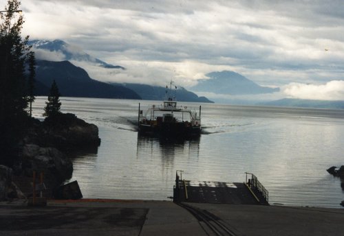
 Three pictures of the ferry between Shelter Bay to Galena Bay and Upper Arrow Lake - Columbia River. The far right picture is of the Columbia River down stream from the ferry crossing on the way to Nakusp, B.C.
22 Jul: Nakusp to Castlegar
Roads: BC8 & BC3A
Distance: 91 miles
There were two hard climbs and then a generally downhill kind of ride. It was not bad and I was first into camp today. This must mean that I was feeling pretty good, the down side was that I got into camp before the baggage truck. I had a good lunch and most importantly I found a beer store!
23 Jul: Castlegar to Grand Forks
Roads: Canada 3
Distance: 58 miles
Started the day with a 24 mile uphill climb to the Aid Station at Bonanza Pass, 4,380 feet, one of the tougher climbers since Monarch Pass in Colorado. There was then a nice 20 mile downhill on the western slope. I had Russian food at a downtown hotel restaurant that was very good. I'm physicallyy OK except for sore achilles tendons (climbing with my toes pointed down too much) but I'm becoming mentally tired..
24 Jul: Gran Forks to Osoyoos
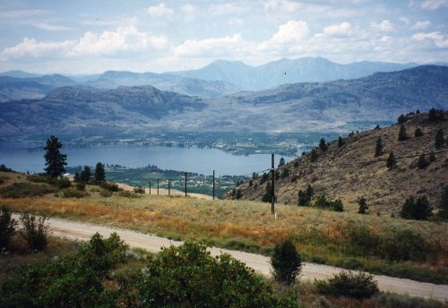
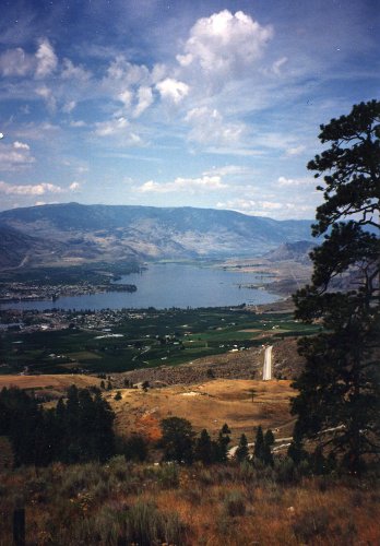
Roads: Canada 3
Distance: 79 miles
There was another morning climb of about 12 miles to Anarchist Summit at 3,600 feet but also an extremely steep downhill into Osoyoos (I would not want to climb it). Today was also very hot at near 100 degrees with a big storm around 6:00 PM that caused some tent damage and left my sleeping bag and tent floor wet. I went with the OFC van to Oroville, WA for dinner but before that happened we drove around and around looking for a Chinese restaurant; a big waste of time. This week is taking its toll without bad weather, the heat and thunderstorms are only going to make it worse.

25 Jul: Osoyoos to Princeton
Roads: Canada 3
Distance: 75 miles
Once again it was a 8 mile climb out of town in the morning which took me about an hour to the summit. Then I got to ride almost all day into a headwind. The only positive was the Italian/Greek dinner in town but camp was 3 miles away so we were once again saved by Sharon and the OFC van. Everyday is hard now!
 This is the picture in the morning, every morning, of leaving a town in British Columbia. There was a climb every morning to get out of town and then a downhill when you arrived at the next one.
26 Jul: Princeton to Hope
Road: Canada 3
Distance: 85 miles
The first climb out of town today took me to Sunday Summit at 4,206 feet then there was a good downhill into a canyon followed by another climb of about 15 miles to Allison Summit at 4,403 feet (the highest in B.C.). This second climb was not that difficult - it was gradual and not as steep as some that we have already done. There was also a long downhill into Hope but I did that with a headwind. Another good Italian dinner but Clyde, the OGF Grand Panjandrum, was a pain once again (I think he is wore out also and that is what gets him in some of his 'moods').
27 Jul: Hope to Lynden, WA
Road: Canada 1, BC7, BC11, WA546 & WA13
Distance: 76 miles
Lynden has the most churches per capita of any town in the USA however there is one bar in town and we are camped 3 miles from it. Then on Sunday our 'duff' day tomorrow everything in Lynden is closed except the churches. I can not think of a worse choice for a town to have a day off in! Today I did get a good dinner at Mothers! Tomorrow I ride some place for breakfast and lunch. It rained last night and was very foggy this morning while riding through a lot of berry fields in Canada and Washington. The WA part of the ride also had a lot of diaries. It was a fair day to end a very tough week that ranks with Utah as the toughest; I now have butt sores that I hope rest tomorrow will help!
28 Jul: Lynden
Road: WA13 (maybe)
Distance: 12 miles
I rode two round trips from camp to Lynden for breakfast and lunch. The OFC van came to my rescue once again for dinner; did not do laundry, that would have taken another 8 mile ride to a laundromat that was maybe open.
Week 8: Washington
 Total distance: 330 miles
Week 8 Route
29 Jul: Lynden to San Juan Island
Roads: WA9, Park Rd, Cain Lake Rd, Friday Creek Rd, Old WA99, Bow Rd, WA237, WA20 & Ferry
Distance: 76 miles
Camp: There were no campsites listed on the map for this week.
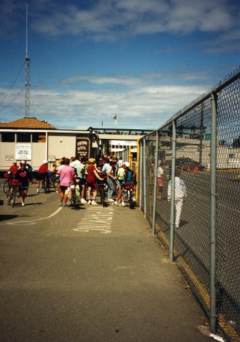
The most complex route that we have had the entire tour to reach Anacortes, then a ferry ride to the San Juan Island and our campsite was then 4 miles from town. There were no restaurants along the route today until about the - way point and the map did not agree with the 'yellow arrows' marking the route. Then when we did get to Anacortes the ferry was 2 hours late. Not a well planned day.
30 Jul: San Juan Island - Friday Harbor
Roads: None
Distance: None
I hitchhiked into Friday Harbor in the morning for breakfast and then stayed in town all day. Got my film from Alberta developed, had a good lunch and then a good Chinese dinner.
31 Jul: San Juan Island to Port Townsend
Roads: City Streets & WA20
Distance: 44 miles
Camp: Port Townsend Motel
A group of us, mostly OFC, went 'off route' today. The official route was a ferry to Sidney, British Columbia then ride some secondary roads that were not marked on the map to Victoria, British Columbia and ferry to Port Angeles; a scheduled 44 mile ride. We ferried to Anacortes and then road through town until we connected with WA20 to Keystone, WA and had a short ferry ride to port Townsend; for the same distance. The tour organizer was very upset with our going 'off route', claimed it was a dangerous route. After some of the routes he has had us on during this tour we told him we were going and would see him in Shelton.
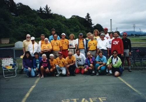
 This is at the ferry dock in Keystone where the incoming ferry will take use to Port Townsend. A picture of most of the 'Breakaway group' at the motel in Port Townsend.
1 Aug: Port Townsend to Shelton
Roads: WA20 & US101
Distance: 74 miles
Our 'off route' cut 28 miles from the combined two day of riding; the scheduled ride today was 102 miles all on US101. I saw very little difference in the safety of riding our route yesterday and what we did today on US101. The director had some other agenda for his displeasure not our safety! Had one of the best buffets on the tour so far in Shelton; salad, soup, oriental main dishes, desert and coffee at $8.50. the past two days have been very nice; a smaller group and self contained makes for a better ride.
2 Aug: Shelton to Raymond
Roads: W Shelton-Matlock Rd, Matlock-Brady Rd, Old WA410, WA107 & US101
Distance: 66 miles
It was very foggy this morning but pushed hard for the first 48 miles to US101. I had a flat and after fixing that I joined up with a pace line through some hills that the weekly riders were calling mountains - they were hills. There is a BIG tour organizer meeting at 4:00; rumored to be a cancellation of the last week of the tour. I have had this feeling that the past two weeks have been 'planned' about two day before we have ridden them. That might have been the issue with the tour organizer, he didn't know where we were going to be for sure and it might also explain no campsite names on the maps.
3 Aug: Raymond to Astoria, OR
Roads: US101
Distance: 58 miles
It was a cool, easy, rolling hills kind of a day! I averaged 15.5 MPH over most parts and was doing 20+ MPH with little effort on others. The two weeks in California are still on but the tour organizer will not be with us (not sure if he gave a good reason) but the staff will carry on. There are small groups of new riders joining us in California but we will have a big group for Oregon and the 'weekies' will be going full blast.
4 Aug: Astoria, OR
Roads: None
Distance: None
Camp: No Oregon campsites shown on the map.
Clyde, Jack and I walked 2 miles to the Pig n Pancake Restaurant for breakfast and then walked back; once again camp is away from town. The morning was very cool and cloudy, afternoon still cool with some clouds and a gentle breeze - great for a nap. I am wore down; Clyde, Jack & Wally are talking about leaving the tour next week, they say they have had enough. There is a photo session this afternoon for all the multi-week riders; maybe the tour organizers are trying to get pictures before everyone leaves.

Week 9: Oregon
 Total distance: 394 miles
Week 9 Route
5 Aug: Astoria to Tillamook
Roads: US101
Distance: 71 miles
We had the same weather as yesterday. I stopped in Seaside for breakfast then rode easy climbs to the Aide Station where I was first in; was also first into camp but the baggage didn't show up until 1:30 because the driver decided to stop and look at the ocean for a while. Had a great dinner at the Rendezvous Restaurant & Lounge. I need to go easy for the rest of the week and try to recover, today was an easy day and I felt good.
6 Aug: Tillamook to Newport
Road: Cape Lookout Rd & US101
Distance: 79 miles
The weather continues the same. We had busy traffic on US101; the road to Cape Lookout was much nicer but about 7 miles longer. Cycle America didn't 'arrow' the route to our campsite in Newport today and I rode an extra 5 miles looking for camp. Very nice scenery today, a goo OFC Meeting and great Mexican food for dinner - a good day.
7 Aug: Newport to Florence
Road: US101
Distance: 51 miles
I did a slow ride with Harriett, Clyde, Jack & Herald for about half of the day. Then rode with Wally and Bill into camp. It was a scenic day and a good rest day on the bike.
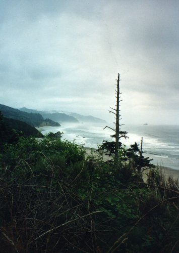
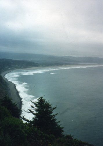
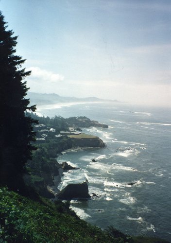
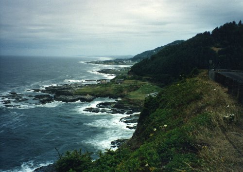
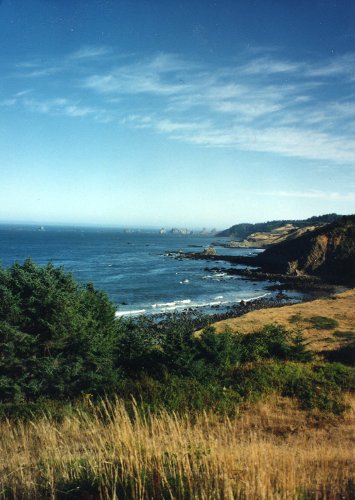
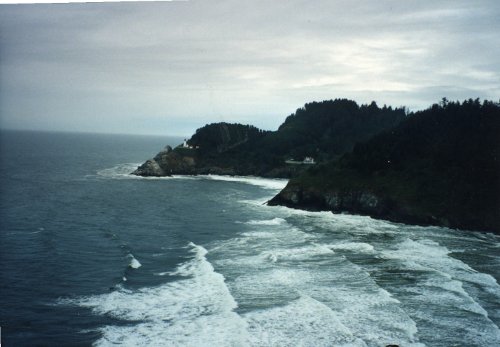 Five pictures of the scenic coast of Oregon; most of the early morning hours were heavy fog so I'm sure these are afternoon pictures.
8 Aug: Florence to Coos Bay
Road: US101
Distance: 53 miles
I rode with the OFC until the Aid Station. Marilyn had waited over 30 minutes for us and then after the group had ridden about 2 miles Clyde wanted to stop again for soup. She wanted to go on so I rode the rest of the way with her at a fast pace to Coos Bay. We had a party at the Firehouse and dinner at pizza place. Raining again this evening; it has rained during the night that past couple of days but it has started early tonight.
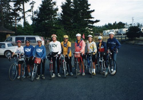
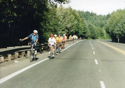 Two pictures of the OFC riding as a group, one of the few times that we have done so. With at least 2 members leaving at the end of the Oregon week it will be the last time this tour.
9 Aug: Coos Bay to Gold Beach
Road: US101
Distance: 86 miles
I rode with Marilyn all day and Bob until he left us at at Port Orford. I was very rainy last night and light rain and heavy fog until about 10:00 AM; it was a wet morning! We had a going away dinner for Clyde a Bill this evening, they are quiting after tomorrows ride into Crescent City and renting a car for the drive to San Francisco.
10 Aug: Gold Beach to Crescent City, CA
Road: US101
Distance: 54 miles
Today was sunny and we had a tail wind; I left camp late and rode easy with Marilyn for a very easy day. There was a good OFC Meeting and Italian dinner plus I got laundry done today. A rest day while on the bike.
11 Aug: Crescent City, CA
Roads: Pebble Beach Rd
Distance: 12 miles
I bought new tires, cleaned bike and tried to adjust the derailleur - I think the rear bearings are going, going, gone. Marilyn and I rode out Pebble Beach Rd to Something Grotto Restaurant and wharf for lunch. It was very scenic and there were a bunch of barking seals along the shore. The new riders 'swarmed' the area where my tent was pitched. I asked one of these new 'weekies' if he had enough room between my tent and Wally's, he disregarded my sarcasm and said that he had plenty of room because he had a small tent. I took my tent down and moved to the center of the football field to get away.
Week 10: Northern California
 Total distance: 528 miles
Week 10 Route
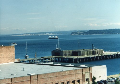
12 Aug: Crescent City to Eureka
Road: US101
Distance: 85 miles
Camp: No campsite names on California maps.
There was a good climb out of Crescent City and then a second one out of Trinidad but I was able to do both in my middle chain-ring. The last 10 miles had some headwinds and bad highway off/on ramps. However, it was one of the easier 85 mile days that I have had in some time.
13 Aug: Eureka to Hayfork
Roads: US101, CA36 & CA3
Distance: 104 miles (third Century)
This was probably the second hardest day of the tour, not as bad as Hites Crossing in Utah but close. The climbing elevation was 8,500 feet with 5 significant climbs; 1) 10% grade for about 2 miles 2) 9% grade for 2 miles 3) 8-9% grades for about 1 mile 4) 8% grade for over 6 miles 5) 8-9% grades for 8 miles in 3 steps. My total time on the road was 11 hours. There were a lot of riders in the 'sag wagon' today.
14 Aug: Hayfork to Red Bluff
Road: CA3, Wildwood Rd & CA36
Distance: 78 miles
Today was much easier with 3 steep downhills and generally downhill after the first 23 miles. I was sore and developed lactic acid build-up very quickly which made it painful to climb. I put a new chain and freewheel on last night but it didn't seem to help. I'm having Mark set it up for friction shifting tonight and will try that for the rest of the tour.
15 Aug: Red Bluff to Shingletown
Road: CA99, CA36, CAA6 & CA44
Distance: 41 miles
Camp: KOA
It was generally uphill all day today. There was a 4 mile 10% grade, in steps, to finish off the day into Shingletown. Then the camp was 4 miles east of town at a KOA; once again the OFC van was so welcome. I rode all day with 'ride easy' on my mind and the climbs were almost easy from a physical standpoint - now I need to work on my head.
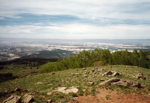
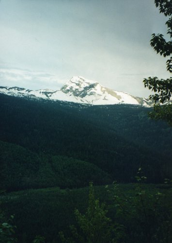
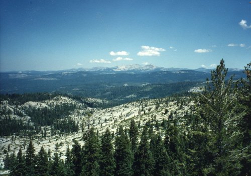
 A picture of the Sierra Nevada from the foothills. Looking back from the foothills near Shingletown across the valley to the Coastal Range.
16 Aug: Shingletown to Chester
Road: CA44, CA89, CA89/36 & CA36
Distance: 72 miles
I had a good breakfast at the Big Wheel Restaurant (west of the KOA) that added 4 miles to the ride today but it was the closest available. The first 36 miles up to and around Mt. Lassen was tough this morning with 4,500 feet of climbing. Then it was a good downhill from the Aid Station to camp.
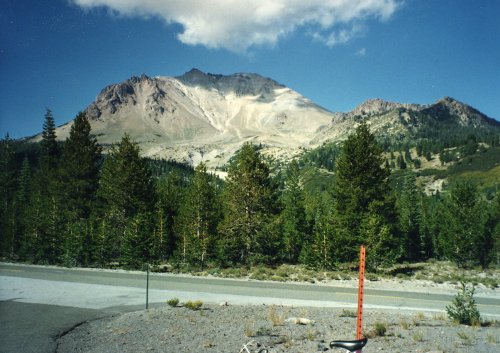
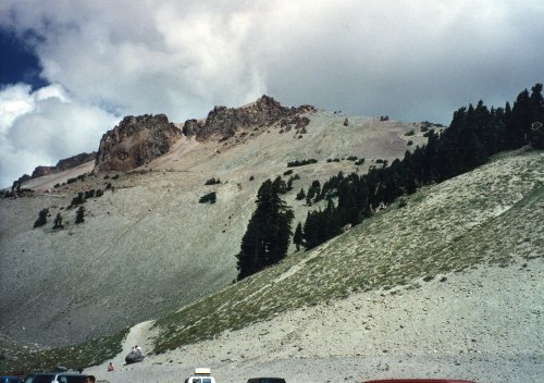
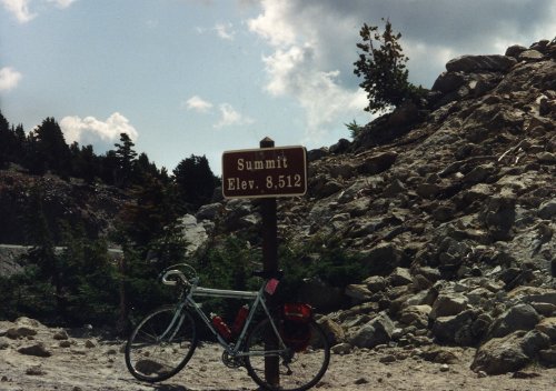
 Three pictures of the peak of Mount Lassen and the summit of CA89 around Mount Lassen. Then two pictures from near the summit; the first is looking north, the second toward the west.
17 Aug: Chester to Quincy
Road: CA36, CA89 & CA89/70
Distance: 48 miles
This was a very easy day with a lot of downhill. I road it as a rest day on the bike; never in a higher gear than a 38x20 and when I started to spin-out I coasted.
18 Aug: Quincy to Sugar Pine State Park
Road: CA89, Truckee City Streets & CA89
Distance: 100 miles (fourth Century)
Camp: Sugar Pine State Park
A long tough day! The first 50 miles were mostly climbing 3,000 feet with light traffic. Starting at the junction of CA89 & CA49 near Sierraville the traffic picked up and the climb out of Sierraville was on a narrow road, no shoulder and heavy traffic going fast. However, Bill Person, who left with Clyde at the end of Oregon, found a wide turn off and was waiting for us with cookies and lemonade - very nice to see him! There is a bike trail that parallels CA89 from Truckee to south of Sugar Pine State Park; I rode it part of the way but did not like it because of the many road crossings. However, when I got on CA89 I didn't like that either because of the traffic - this is not a good area to ride in if you want to do so at a fast pace.
19 Aug: Sugar Pine State Park
Road: None
Distance: None
Camp: Sugar Pine State Park
I went with the OFC van to Stateline to gamble a little and a big brunch. I called John and Janice while I was there and talked to them a bit and also Sheri (a cross country rider from Hercules, CA). We then had a supermarket stop and that was it for the day - it was a 'duff' day and I duffed!
Week 11: Central California
Total distance: 359 miles
Week 11 Route
20 Aug: Sugar Pine State Park to Bear River Lake Lodge
Road: CA89, CA88 & Road to Lake
Distance: 71 miles
Camp: Bear River Lake Campground near Lodge
The map for the week indicated we were going to Pioneer but the camp was about 18 miles east of there at Bear River Lake. It is good that the distance was less because we climbed 3 passes; Luther pass, at 7,740 feet, Carson Pass, at 8,575 feet, and Carson Spur, at 7,990 feet. The campground was the second worse that we have had, Hites Crossing taking the first place; dirt campground and dirty showers. I rode alone almost all the way and was sixth into the Aide Station but first into camp. Mary T. came out to see us, she was one of the original OFC Members when the club was formed during the 1988 cross country crossing. She now lives in Carmichael and works as a nurse at the Davis Hospital.
21 Aug: Bear River Lake Lodge to Folsom
Road: Road from Lake, CA88, Fiddletown Rd, CA49, CA16, Latrobe Rd & Placerville Rd/White Rock Rd, Scott Rd/Bidwell Rd
Distance: 65 miles
Camp: Folsom High School (I think)
The map for the week indicated this was to be a 100 mile ride from Pioneer; I don't know where they would have had us go to get up to 100 miles but I'm glad that it didn't happen. It was a great day with almost all of it downhill! I had ridden a lot of the roads in this area before but today was my first time on Latrobe Rd and I found it to be OK.
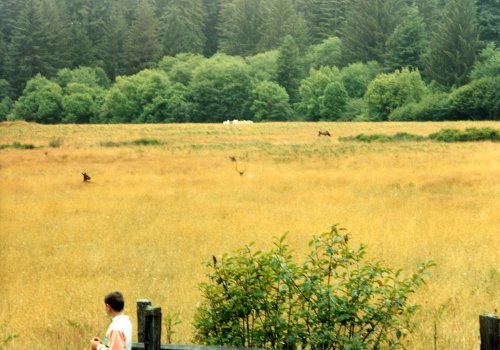
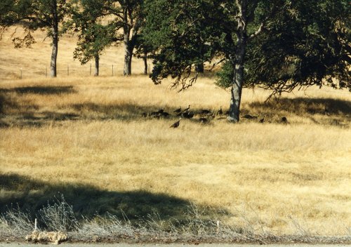 A flock of wild turkeys near Folsom.
22 Aug: Folsom to Winters
Road: Folsom City Streets, American River Bike Trail, Capital Av, I-80 Bike Trail, I-80 Frontage Rd & Covell Rd(CAE6)
Distance: 60 miles
I ignored the 'yellow arrows' as I approached Davis and took Covell Rd which I had ridden before to get around Davis to Winters. I seems that some of the riders got lost in Davis because of the 'yellow arrows'. I rode the American River bike Trail with Harriet, Recumbent Bob & Tim then alone for the rest of the route.
23 Aug: Winters to Calistoga
Road: CA128, Silverado Trail & CA29
Distance: 46 miles
Once again camp was 5 miles from the town; a very poor site with bad showers and no shade - another 'miles away camp' that had poor facilities. I saw Sheri and Jackie in Calistoga (two Cross Country riders from last year); it was good of them to come out to see us. I had ridden most of the route before and found 'Cardiac Hill' near Lake Berryessa to be not nearly as bad as had remembered it.
24 Aug: Calistoga to Olema
Road: CA128, Alexander Valley Rd, Healsberg Av/Old Redwood Hwy, Eastside Rd/Laguna Rd, CA116/Gravenstein Hwy, Lone Pine Rd/Bloomfield Rd, Valley Ford Rd & CA1
Distance: 82 miles
This was a somewhat hilly route along Tomales Bay with headwinds part of the way. I have ridden in parts of this area before and it seemed that the route was longer and had more hills than were necessary. I don't have notes on this but I think this was the day that Beth (Staff) was challenged by other Staff to catch me before I got to camp. I'm not sure what my head start was but if I remember correctly she did pass me with about 2 miles remaining.
25 Aug: Olema to San Francisco
Road: Sir Francis Drake Blvd, College Av/Magnolia Av/Camino Alto/Miller Av, City Street to Bridgeway Blvd, Golden Gate Bridge, US101 to Crissy Field
Distance: 35 miles
This last day was a victory ride into San Francisco. I was with a group almost all day that had someone that was familiar with the roads in the area and I just followed along; the group was 7 then grew to 16 and was at 18 when we crossed Golden Gate Bridge. The roads that I have shown above are my best guess at what we were on. There was then a party at Crissy Field and we said our goodbyes. I said then that I doubted that I would be doing any long tours in the near future - this one has done me in!
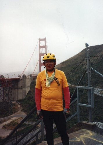
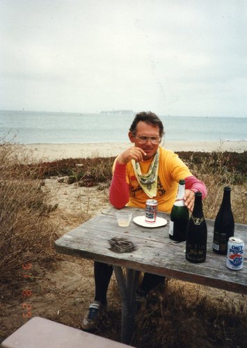 Yours truly at the end of the tour; the first is in front of the Golden Gate Bridge north side, the second is in Crissy Field with celebratory champagne and Bud Light!
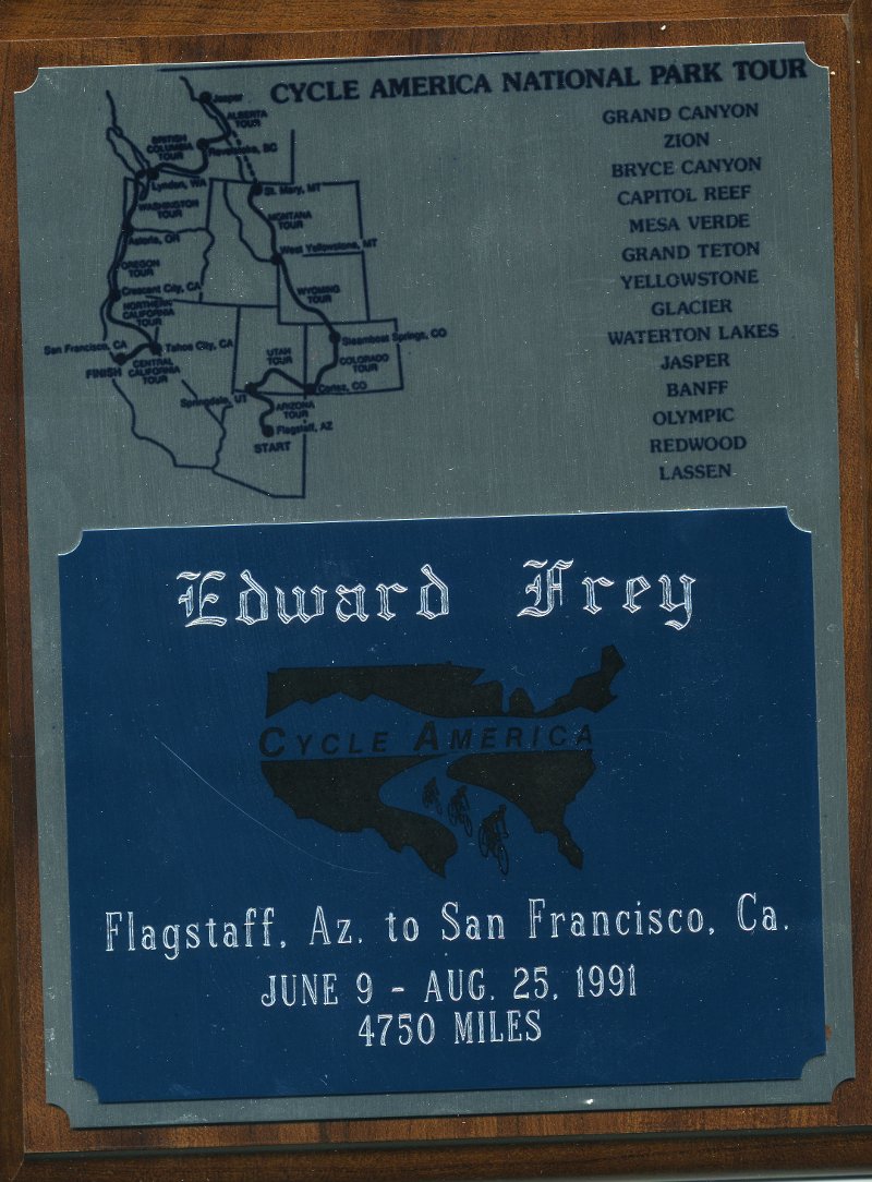 My trophy plaque from Cycle America for completing the Western Tour; the only trophy that I still keep.
Epilogue: The Tour End Party was not very long and riders were making there way out of town. I had inquired of the Staff if I could get a ride with them to Sacramento as they were driving back to MN. When I got to Sacramento I had them drop me at a house that was owned by a woman that I had meet through bicycle club rides who rented rooms in one of the big homes in 'old town'. I think I stayed overnight and then caught a plane to Las Vegas where my cousin picked me up and took me to her home and a reunion with my car. I then drove back to Sacramento, enroled in an H & R Block Tax Class and then did taxes for them during the tax season of 1992.When tax season was over I knew that I was not going to spend another winter in the Sacramento/Central California Valley because of the 'tulle' fog. I had received invitations to join the OFC for a Natchez Trace Parkway ride and decided to combine it with a job search and domicile move. That is covered in two parts: Midwest Turnaround - a Car Road Trip & Natchez Trace - a Bike Tour which can be found in the Archives.