Baja
Phoenix, AZ to La Paz, Baja, Mexico

April 1975
2,396 Miles
Route To La Paz

To re-create a journal for this trip I have some photographs and my memory, that is all. The trip mileage that I have shown above is an approximation as are the individual day miles and the maps. I believe the year of 1975 is correct but the month my be wrong, I know it was in the spring to avoid the heat. I am not sure of the exact dates so I have shown the trip as day 1, day 2 etc. I know the pictures were not in the order that they were taken when I first looked at them to prepare this journal and I have attempted to put them in that order but may still have errors. So, with all of that said I will rely on my faulty memory and try to put together a journal and captions for the pictures.
Day 1: Phoenix, AZ to San Luis Rio Colorado, Sonora, Mexico
Roads: City Streets, I-10, AZ85, I-8, US95 & MEX2
Distance: 209 miles
Camp: Off Road MEX2
This was in the days when I did not try to avoid Interstate Highways so I have chosen the route shown above, although I don't remember that this is correct I think it is. I would not do it today but I found a place to pull off of MEX2 and settled in for the night. I knew that I would be on dirt roads on Day 2 and I didn't want to try finding turns in the dark. This was in a simpler time without all the drug gang warfare along the border that we have now, it was not uncommon to do what I did and just pull off the road for the night. The highway MEX3 was not paved all the way across from east to west in 1975, I think it was only paved to Ojos Negros from MEX1 on the western end.
Day 2: San Luis Rio Colorado, Sonora to San Quintin, Baja, Norte, Mexico
Roads: MEX2, MEX5, MEX3 (single track dirt), Dirt Roads & MEX1
Distance: 280 miles
Camp: Off Road MEX1
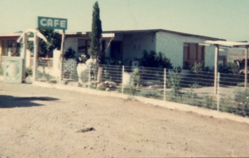
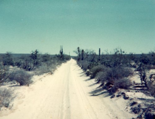
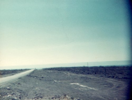
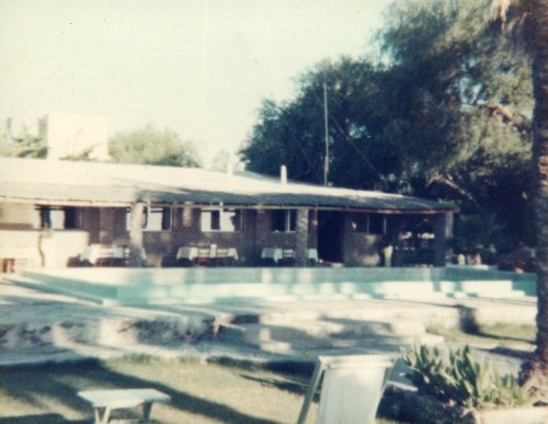
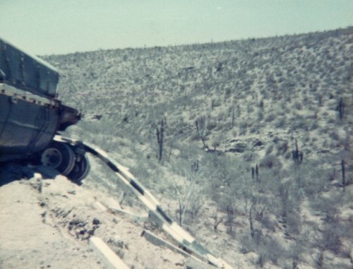
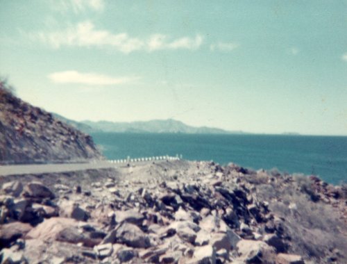
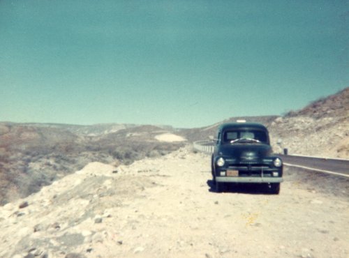
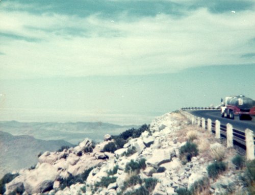
Today was an experience! I was on paved road until I turned onto MEX3 to cross through the Sierra San Pedro Martir by way of Mike's Sky Ranch. It was 36 miles from MEX5 to the turn south to Mike's Sky Ranch and about half way there I saw a speck with a big dust cloud behind it. As this speck got closed and took on better definition I could see that it was vehicle moving toward me at high speed; I was doing maybe 25 MPH. As it came closer I moved out of the single track so that my left wheel was in the right tire track, my right wheel was out in the brush, I was in low gear and doing maybe 5 MPH. The Baja racer came by me with their left wheel on the road center at a speed that I guessed to be over 60 MPH. I only had a fleeting look at the driver and co-pilot; they both had what looked like gas masks on with a flexible hose from the mask to an air filter on top of the racer. They passed and I stopped for a few minutes to allow the dust to clear before I tried to get back in the track and continue. After the turn south it was 22 miles to Mike's and maybe 15 miles into it I saw that my generator dial was indicating that my generator was not working. Then about that same time as I was nearing the crest of a steep hill I had a motorcycle leap over the summit, all wheels off the ground, and land about 50 feet in front of me. I saw the rider throw his hand high in the air when he saw me and I stopped quickly; there were then 5 more motorcycles come leaping over that same summit and landed in almost the same place. I proceeded then to Mike's with even more trepidation but had no more "traffic". When I got there I asked where I might get my generator looked at and was told that there was a shop in Colonet. The truck started OK at Mike's and I reached San Telmo where I stopped for gas from one of those pumps that had the glass bowl on top; you hand pumped the gas into the bowl and then gravity feed into your tank. I kept the truck running while I was there because I saw no other vehicle around that could help me get started again. I then made it to Colonet, found the generator shop and during the next 2-3 hours I watched a young man, maybe 18 years old, strip the armature of its old windings and then hand wind on new wire. Put the generator back on the truck and it worked fine; in fact it was still working fine when I sold the truck in 1982. I stopped at the San Quintin La Pinta Hotel for dinner, there are a chain of La Pintas that the Mexican Government has built to provide accommodations since MEX1 paving was completed (the completed road was dedicated on December 1, 1973). However, I was traveling on a budget and sought another turn-out off of MEX1 for my nights lodging.
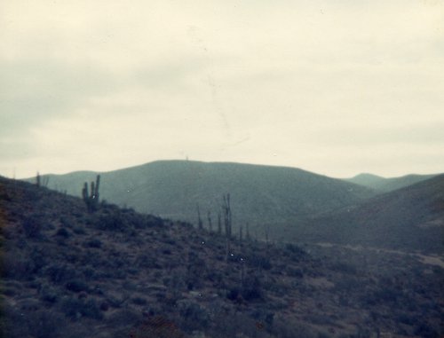
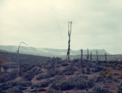
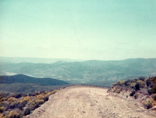
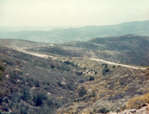
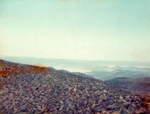
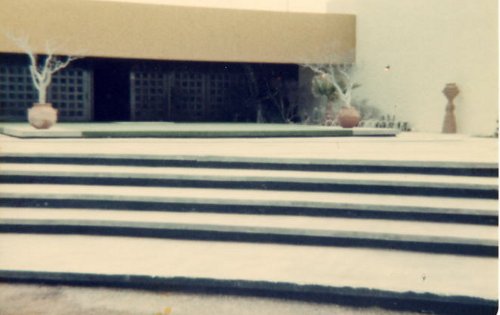
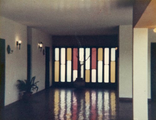

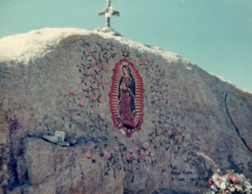
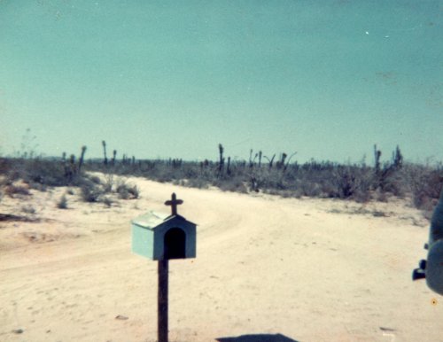
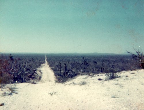
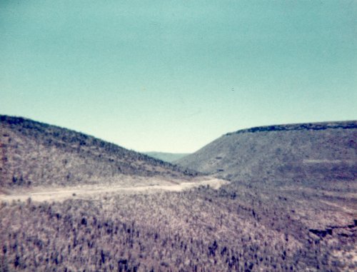
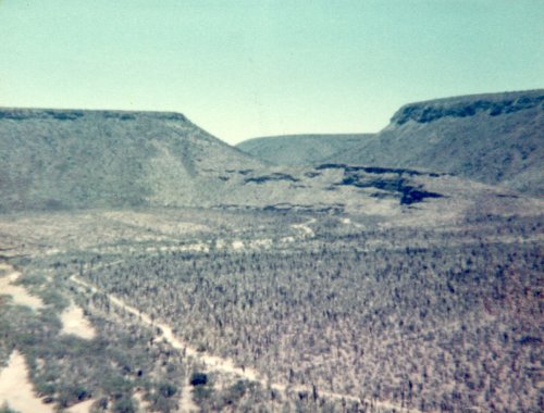
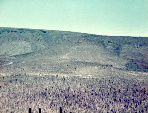
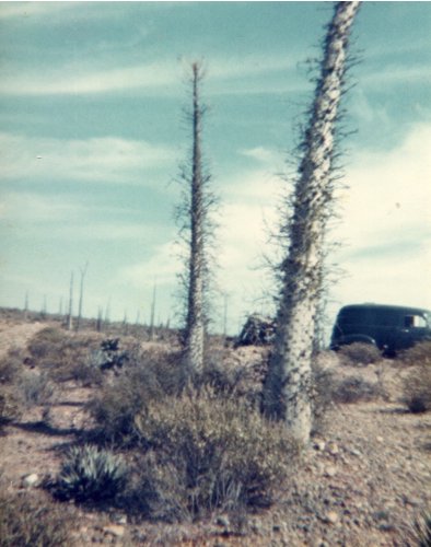
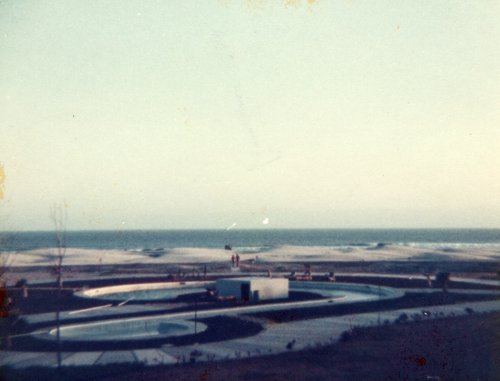
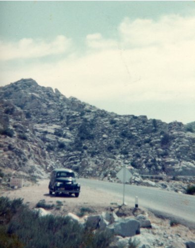
The first five pictures are of the Sierra San Pedro Martir. The first and second also show some boojom cactus , the first time that I have ever seen them. The third and fourth pictures show the dirt road to or from Mike's Sky Ranch. Then the last three are of the San Quintin La Pinta Hotel. First the entrance, part of the lobby area and the Spanish style center courtyard. I don't remember the other La Pintas having this central courtyard but they might.
Day3: San Quintin to San Ignacio, Baja Sur, Mexico
Roads: MEX1, Dirt Road & MEX1
Distance: 253 miles
Camp: Oasis (I think) now called El Padrino RV Park
Tijuana to La Paz Road
Driving south on MEX1 this morning took me through the rocks and boojum cactus around Catavina which was very scenic. Then about 30 miles south of the junction with the road to Bahia de Los Angeles just past Rosarito I turned to the east on the original Tijuana to La Paz road. It remains much as it has been for many years and I wanted to get some idea of what it was like before the paved road was completed. The map that I have shown above is the bestapproximation that I can draw. After about 50 miles I arrived in El Arco, a small town, that is as centered within Baja as any place you could pick. I think the town is split by the boundary line between Baja Norte and Baja Sur and is mid-way from east to west across Baja. It was another 30 miles from there until I joined MEX1 where there is now a gas station (none in 1975). I think I had dinner at the San Ignacio La Pinta which was adjacent to the campground where I parked for the night.
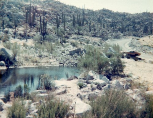
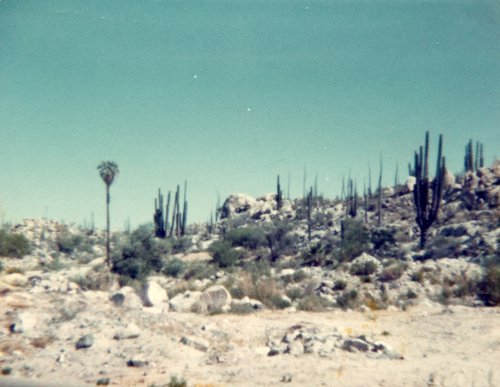
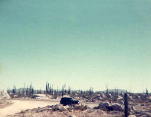
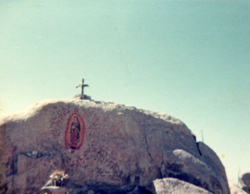
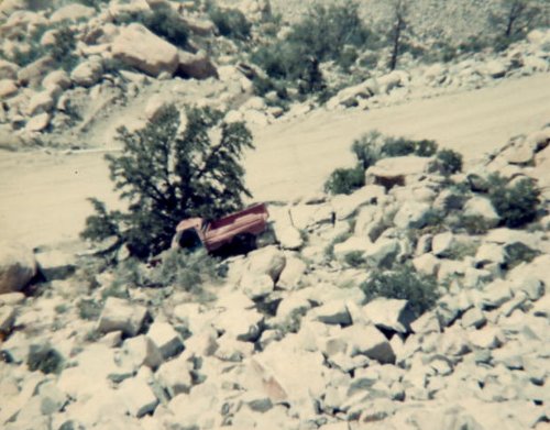
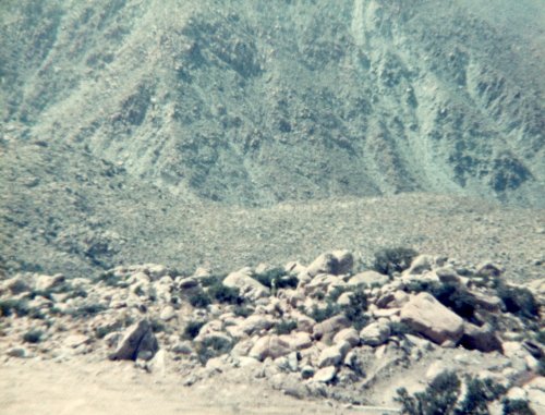
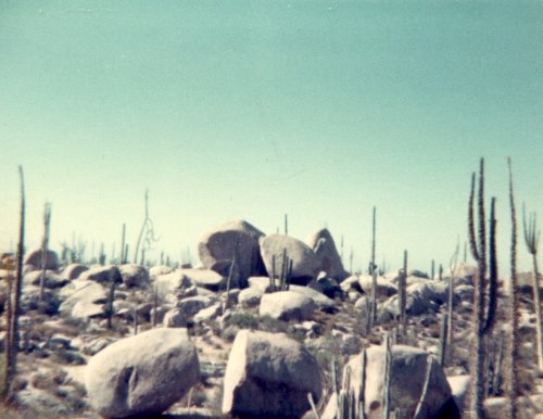 Catavina: This first picture shows a lot. There is the catchment with water in it which is unusual for Baja and indicates that it has been a wet spring. Second there are the cardon cactus, similar to the saguaro but smaller. Then the third thing shown is the results of careless driving on MEX1, the car failed to negotiate the curve and ended up mostly off the road on some rocks. Then three pictures of the rocks and cactus; a mix of boojum, cardon and oregon pipe, near Catavina. In the third picture you get to see my truck for the first time.
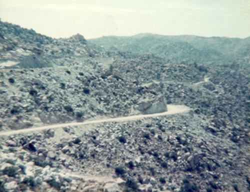
 El Arco: The road from MEX1 to El Arco; not the El Arco at the tip of the peninsula by Cabo San Lucas but the town in the center of the peninsula. The church at El Arco and a fork in the road. As Yogi said "when you come to a fork in the road take it". The road directly behind the small shrine goes to Guerrero Negro (I think) and to the right of the picture is the road straight ahead to MEX1 and San Ignacio. The picture on the left is that road straight ahead that I was referring to.
Day 4: San Ignacio to Loreto, Baja Sur, Mexico
Roads: MEX1
Distance: 167 miles
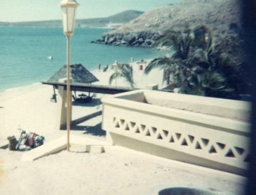
Camp: Flying Sportsman's Lodge (now the Villas de Loreto)
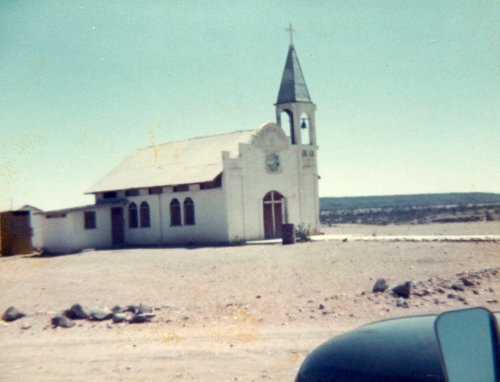
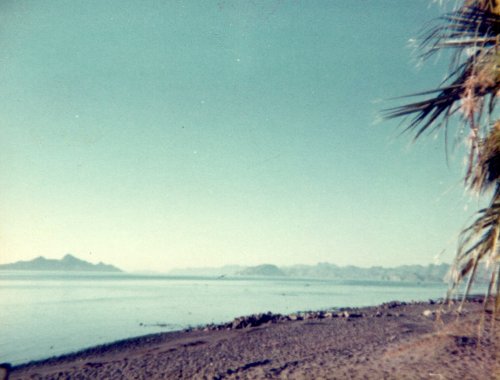
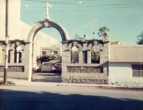
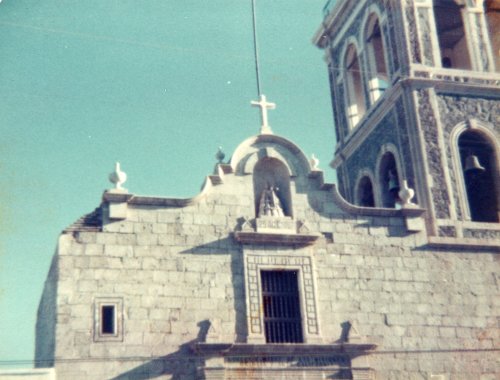
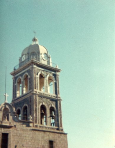
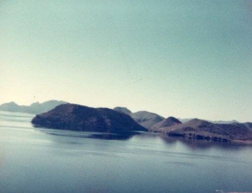
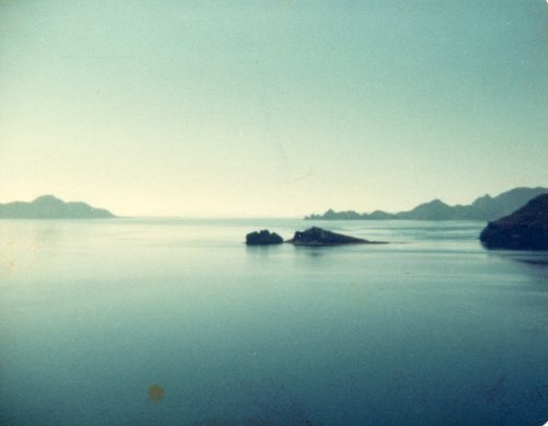
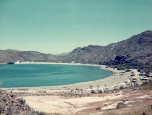
It was only a short drive today but with 2-3 stops along the way it fill the time. I left San Ignacio after breakfast and after getting a few pictures of the church. It is built with blocks of volcanic rock with 4 feet thickness that was initiated by the Jesuit Fernando Consag and was concluded by the Dominic Juan Crisostomo Gomez in 1786. Because of its construction it has withstood the test of time better than most missions in Baja and is well worth seeing. I then stopped along the way, and in, Santa Rosalia as well as Mulege and along the Gulf of California. In Loreto I got an RV spot next to the Lodge and right on the beach; I think that I had dinner at the Lodge and probably breakfast on Day 5.
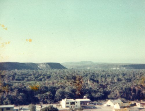
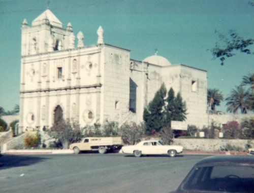
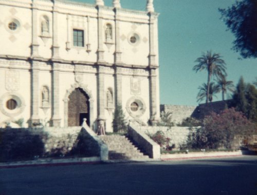
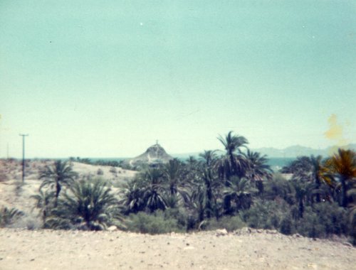
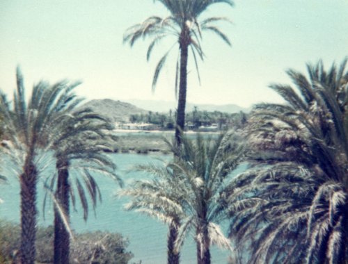
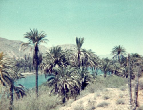
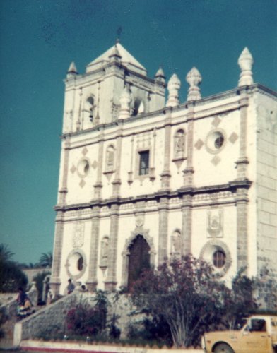 San Ignacio: This is the San Ignacio valley filled with date palms, a true oasis in the middle of a desert. Then three pictures of the San Ignacio Mission.
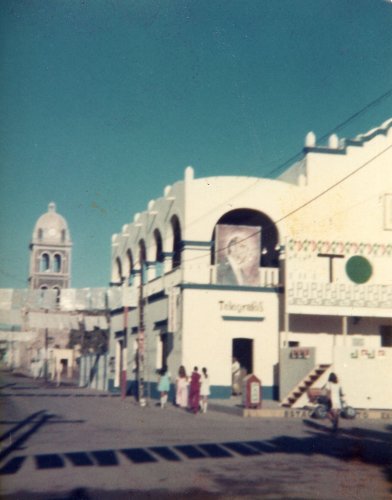
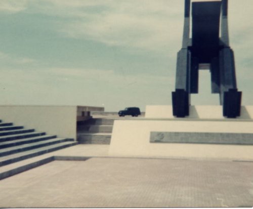
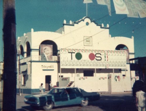 Two pictures of the government building in Loreto; the platform is for a Presidential candidate that has been one day behind me since San Quintin. He will be here tomorrow making his campaign speech, kissing babies and making promises; just like in the good 'ol USA. The first picture also shows the mission tower.
Day 5: Loreto to La Paz, Baja Sur, Mexico
Roads: MEX1 & City Streets
Distance: 223 miles
Camp: RV Park
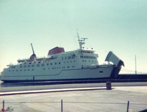
Nothing much to comment on about today. There was a motorcycle rider that I kept passing when he stopped to take a break and then he would pass me. I found him near the ferry dock when I got into La Paz and stopped again to talk to him. He was from the Netherlands, in his early 20s, and had come to Canada by ship, bought the motorcycle there rode across most of the USA and now Baja. His plan was to ferry to the mainland Mexico and ride to Panama where he will catch a ship to the Netherlands Antilles and then back home. I drove around and asked around until I found an RV Park where I could stay for a few days, didn't look around La Paz much except to find the Park.
 Ville Insurgentes: Three pictures of the east-west canyon from Loreto the plains to the town of Ville Insurgentes. Two pictures of what can happen in the canyon or almost anywhere along MEX1; it is not very wide and in most place has no shoulder.

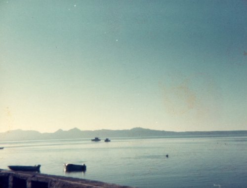
 La Paz: This is the harbor in La Paz with the ferry dock to the right, around the point of land, in the first picture.
Day 6: La Paz, Baja Sur, Mexico
Roads: None
Distance: None
Camp: RV Park
I am sick! I awoke early this morning with stomach cramps and a bad, bad case of diarrhea that has had me make the 25 yard trip to the bathroom about every 30 minutes or one hour for most of the day. A fellow camper saw my distress and came over in the afternoon and gave me enough Lomotil to last for 6 days that should help get me home. I did manage to get a couple of naps in the late afternoon when the first pill seem to be doing some good. If I feel at all like I can drive in the morning I'm on my way back to Phoenix and hope I get better along the way; if not at least I'll be closer than here.
Route From La Paz
Day 7: La Paz to San Ignacio, Baja Sur, Mexico
Roads: MEX1
Distance: 390 miles
Camp: San Ignacio La Pinta Hotel
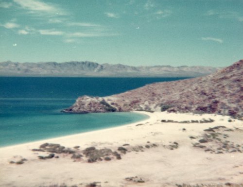
I felt that I could drive this morning since my bathroom trips have decreased considerably; they should since I have had no food since day before yesterday, but I couldn't even hold liquids before I started on the Lomotil. I made a few stops along the way today; the first couple were to get some more pictures of Bahia Concepcion and bathroom relief the last one was not planned. As I was climbing the grade from Santa Rosalia to San Ignacio my truck engine quit running and I was lucky that I could coast to a wide turn-off. I attempted to re-start the engine and the starter would turn over but the engine would not fire. I'm no mechanic, but I thought I would raise the hood and look around and perhaps someone that did know something would see my trouble and take pity on this poor stranded gringo. I did look under the hood for a few minutes, saw nothing, then did a few walks around the truck in puzzlement and contemplation of my situation because I had not had anyone come by in the 10 minutes or so that I had been there. Had another look under the hood and by blind luck noticed that the ground wire from the bottom of the coil to the engine block had broken where it attached to the block. I had enough length in the wire that I could strip the end of its insulation and attach it to the block once again - Eureka, it worked! I continued on to San Iganacio and got a room in the La Pinta so that I was close to a bathroom; I'm better but not cured.
Day 8: San Ignacio, Baja Sur to San Quintin, Baja Norte, Mexico
Roads: MEX1
Distance: 345 miles
Camp: San Quintin La Pinta
Nothing much about this day but trying to get home. I did stop a few times for some pictures and don't remember any emergency bathroom stops. I did eat some solid food once again last night and this morning.
Day 9: San Quintin, Baja Sur, Mexico to Phoenix, AZ
Roads: MEX1, MEX3, MEX2, US95, I-8, AZ 85, I-10 & City Streets
Distance: 529 miles
Camp: Home
The only excitement that I had today was when I stopped at a Mexican road check point near Ensenada and they wanted to see my Tourist Card that I should have had to go to La Paz. Because of the way I had driven into Baja I had bypassed the normal check points going south and never got a card. If you go to San Felipe on MEX5 you did not need one in 1975; the same thing was true of Puerto Penasco, Sonora that I had been many times so I didn't think about it. The police were somewhat concerned, and my limited Spanish did not help, until I got my map out and showed then where I had entered and where I had been. They then just shrugged their shoulders and waved me on - another crazy gringo. I did make an emergency bathroom stop along MEX2; perhaps I over did it with solid food? From there on it was just a long drive home and get well before going back to work. My two week vacation in Mexico was shortened somewhat because I got sick but I saw a lot and it was well worth it.
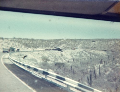
 La Rumorosa Grade: Five pictures of La Rumorosa Grade which is to the west of Mexicali. A very steep and somewhat twisty grade from the mountains down to the Colorado River plains.
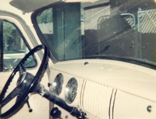

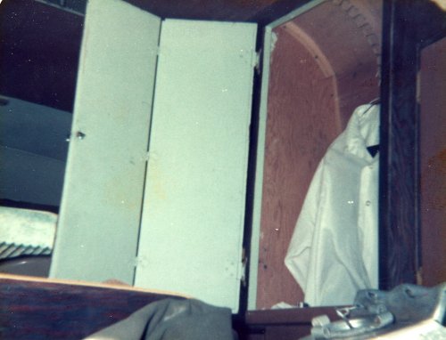
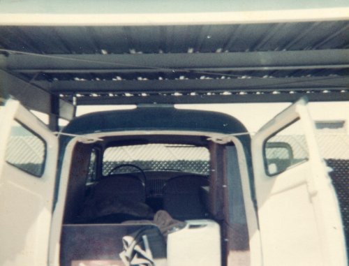
 Truck Interior: Five pictures of my truck interior where I lived for at least part of this trip. It has a bed, one burner propane stove, an ice chest as well as lots of storage space but no bathroom or running water.