Natchez Trace
Natchez, MS to Leipers Fork, TN
1 - 14 May 1992
506 Miles
Total Tour

For this Tour I do have some journal notes, a good map of the Trace and I did take some pictures but have no captions or the dates taken. I will try to re-construct a journal and use it as a base for the pictures that I have. This bicycle tour was in the middle of a car road trip that I have added to the Site Map as 'Mid-West Loop' under 'Car Road Trips' or you can get there with Mid-West Loop
1 May: Round trip Gordon's Ferry to Leipers Fork,TN

Distance: 44 miles
Camp: Meriwether Lewis Campground
Route
I met Wally at the camp yesterday and will use his trailer while we are here. Today we drove in his truck to the start of our ride, rode to the end of developed Trace and then back to the truck. We went to Hohenwald, TN for dinner at the General Cafe the last two nights with breakfast and snacks in the trailer.
2 May: Round trip Meriwether Lewis Campground to Gordon's Ferry, TN
Distance: 50 miles
Camp: Meriwether Lewis Campground
Route
Today Wally and I rode a round trip from camp to where we had started yesterday and have now ridden all of the Trace north of camp. We went into Hohenwald again for dinner but had breakfast and lunch in the trailer.
3 May: Round trip Meriwether Lewis Campground to Dogwood Mudhole, TN
Distance: 47 miles
Camp: Meriwether Lewis Campground
Route
We tried another restaurant tonight that was not as good as the General Cafe. I thought it was called the Natches Trace Inn but can not find such restaurant near Meriwether now so it closed or I had the name wrong.
4 May: Meriwether Lewis Campground
Distance: None
Camp: Meriwether Lewis Campground
We drove into Franklin, TN and had a 'duff' day waiting for the other OFC riders to show up. We all then went to the Golden Corral Cafe, west of Hohenwald, for dinner and stopped in at Wild Bill's Bar in Hohenwald. It is what you may kindly describe as a 'dive bar' but a perfect OFC place; there was a local story teller there that even put the OFCers to shame.
5 May: Meriwether Lewis Campground, TN to Natchez, MS

Distance: None by bicycle
Camp: Natchez Motel
I left my car at the Campground, wally left his trailer but I think he drove his truck, and rode with others to Natches, MS. I was riding with Clyde and Millie and as we drove south we stopped at motels along the way to make reservations for our stops as we rode north. We were also checking for a place that we could plant a tree as a memorial to Ray who had died only a few weeks after the Western Tour last year. There were no rooms available in Port Gibson but we cut a deal for 7 rooms at a B & B for $65 each that were normally $75 to $95.
6 May: Natchez, MS
Distance: None
Camp: Natchez Motel
We did a walking tour of Natchez today and had dinner at a Mexican restaurant. Lunch had been at Fat Mamma's Tamales, so it was Mexican food day. There was a cold wind blowing for most of the day but enjoyed the walk around town.
7 May: Natchez to Port Gibson, MS
Distance: 44 miles
Camp: Oak Square Plantation B & B
Route
Nothing much to comment on about the ride today. The B & B is very nice and the owner almost demanded that we take a tour through all of the house to see everything, lots of antiques a period 'stuff' of the antebellum South.
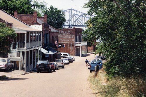
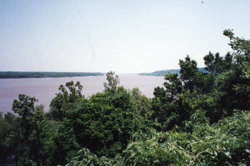
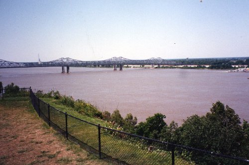
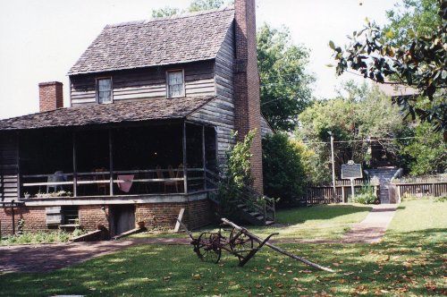
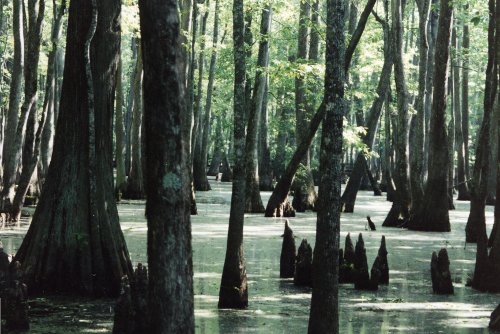
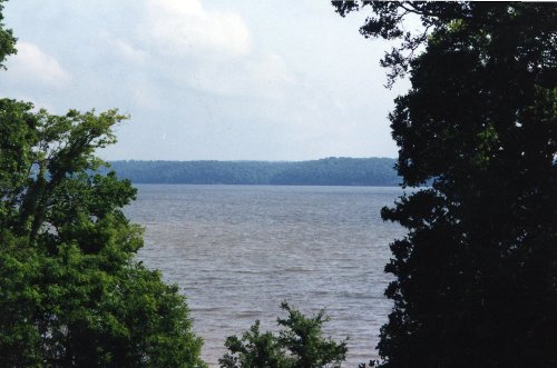
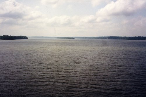
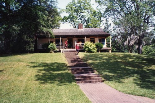 A picture of Natchez 'Under the Hill', the town docks and red light district of Natchez during the steamboat and flatboat era. Then two pictures of the Mississippi; the first is looking up stream and the second downstream where the US Hwy 84 bridge crosses. Mount Locust, one of the earliest 'stands' or inns along the Trace that has been restored and is used as a Ranger Station.
8 May: Port Gibson to Jackson, MS
Distance: 72 miles
Camp: Red Roof Inn Motel
Route
We had a very good breakfast at the Oak Square Plantation and an easy ride to Dean's Stand (only the northern part of the Trace has any hills at all and they are gentle) where we planted a tree in memory of Ray. Bill, Betty and I rode the Jackson Trace By-Pass to the Red Roof Inn getting there by 3:00 PM; I think some of the other riders rode through Jackson or sagged in. Dinner was at Applebee's which I think was close by.
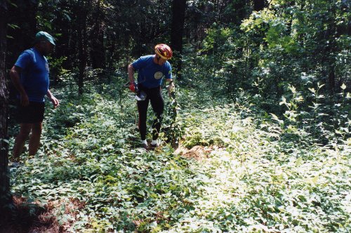
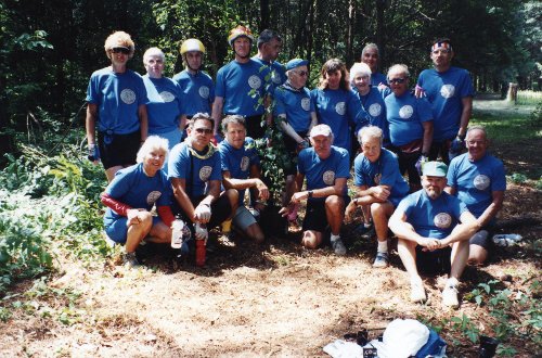
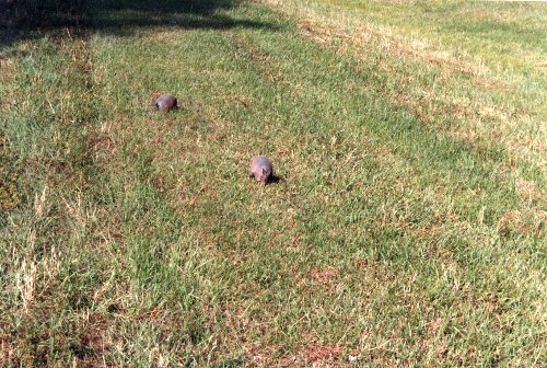
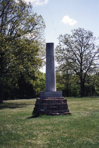
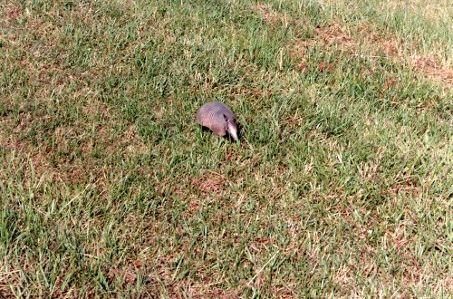 Two pictures at Dean's Stand where we planted a tree in memory of Ray. Plus a couple of photos of armadillo along the Trace north of Jackson (I think these were the first that I ever saw up close).
9 May: Jackson to Kosciusko, MS
Distance: 63 miles
Camp: Best Western -Parkway
Route
I rode at a slow pace today, resting while on the bike. Our dinner spot was GAF's which had a buffet where I loaded up on fried oysters and fried okra. Can't get fried okra in Reno! We have people leaving and going there own way already which is OK but we will be loosing our baggage truck and driver. We will take turns for the rest of the Trace driving a sag/baggage truck (I think Wally's).
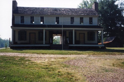
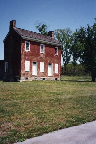
 I think this is Brashear's Stand, an inn that was advertised as a house of entertainment in the wilderness to travelers in 1806. It is built in a 'dog run' or 'dog trot' style with the breezeway in the center; it is rare that you see this style in two stories (the second is probably a later addition).
10 May: Kosciusko to Mathiston, MS
Distance: 47 miles
Camp: Mathiston Motel
Route
I felt tired today with muscle soreness and a sore butt. I'll get a break from the bike and drive the sag/baggage truck tomorrow to Tupelo, MS; do my laundry and get to a bank.
11 May: Mathiston to Tupelo, MS
Distance: None by bicycle
Camp: Comfort Inn Motel
Route
I drove to Tupelo and did no riding today. I did the chores that I had planned and then we watched a video tape of our current trip that Homer has been shooting. Also watched last years tape that someone had brought.
12 May: Tupelo to Tishomingo State Park, MS
Distance: 49 miles
Camp: Cabin in the Park
Route
The ride today was over by noon. We had a very nice cabin in Tishomingo State Park that was probably built in the 1930s. It had a bed, two roll-aways and a sofa with a refrigerator and stove in the kitchen area. There was also double fireplaces and a screened porch. Clyde did the dinner cooking and Milly will make breakfast for us tomorrow - what a life!
13 May: Tishomingo State Park, MS to Waynesboro, TN
Distance: 73 miles
Camp: Natchez Trace Motel
Route
I didn't make a note of where we stayed tonight but I think we rode off the trace to Waynesboro. This was my longest day and some of it was into a headwind and the start of hills - I'm tired and sore. It was also a three state day; we left from Mississippi, road through Alabama (about 30 miles) and finished in Tennessee. Ed R. of TN left today at about 2:00 PM, he was not too far from home. I will stop tomorrow at my car and then drive to Franklin where we are going to say our farewells, those of us that have not left already.

14 May: Waynesboro to Franklin, TN
Distance: 17 miles by bicycle
Camp: Best Western - Maxwell
Route
It was only a short ride to pick up my car and then drive to Franklin for this last evening. I was appointed to a Nomination Committee for new OFC Members for the OFC; I think Clyde and Wally have gone around the bend on this members issue - no one else cares! I think I'll just wish the OFC , as an organization, to rest in peace.
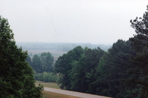
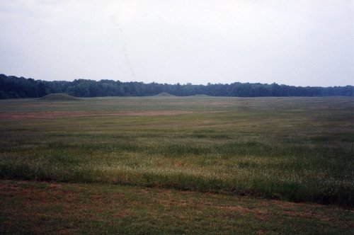
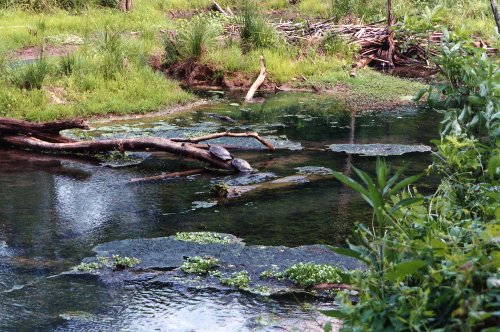
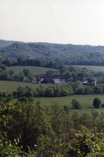
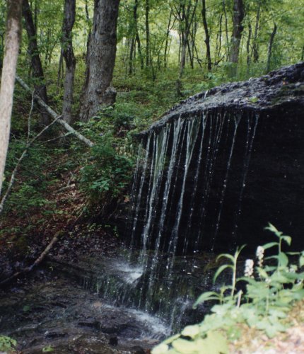
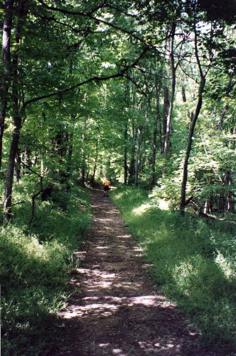
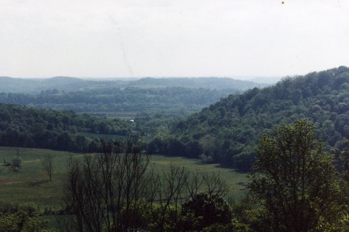
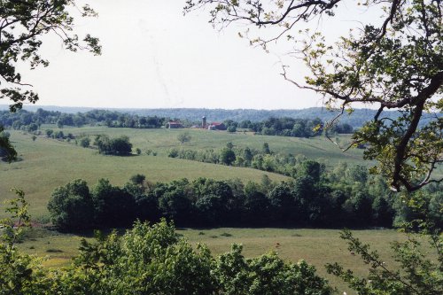
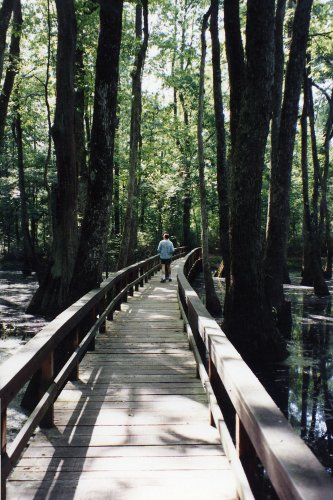
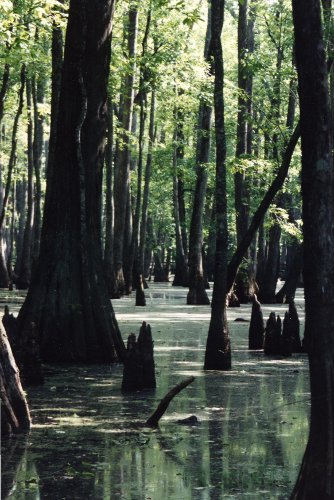
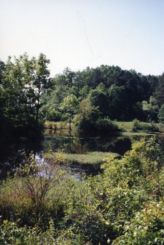 A couple of pictures of field like what you see all along the Trace when the trees allow. In the first picture you can also see a parallel road that is not part of the Parkway. A couple pictures also of streams which are quite frequent along the Trace. The walk back to Nashville included a lot of water crossings! In the first picture you can see two large turtles on a log; there were more but they slipped into the water while I was getting my camera out.
Epilogue: There was another OFC memorial ride on the Natches Trace in 1997 while I was in Bulgaria; that one was for Bob, Harriet's husband. We have had a number of other OFC Members die over the years but no more Memorial rides.