Mid-West Loop Car Trip
18 April - 20 May, 1992
The Summary
Miles: 6,165
Fuel Economy: 34.85 MPG
Duration of the trip: 33 days
States Visited: 14
Total Trip

18 Apr: Sacramento, CA to West Covina, CA

Roads: City Streets, I-5, I-10 & City Streets
Camp: Jody's
Route
I did not keep notes on what roads I took for the first part of this trip but I have compared what I wrote down as the mileage each day with the Map Quest mileage for the route that I have shown and it is very close. Therefore, I'm going to use Map Quest roads where I have not noted them. I had a good pizza at Napoli while waiting for Jody to get home from work and then we visited for the evening.
19 Apr: West Covina to Upland, CA
Roads: Arrow Hwy
Camp: Todi's
Route
I left Jody's early before she had to leave for work and drove through towns to my Great Aunt Todi's (my grandmother's sister) in Upland. Her home was only two blocks from where I had bought a house when I moved to CA in 1982 and about 5 blocks from where I was born. This is also only 3 blocks from Madonna of the Trail statue #12 (counting from east to west). Later in the afternoon we went to my cousin Bill's (second cousin I think, the son of my father's cousin or the son of the daughter of My Great Aunt Letha) place for Easter Dinner. The day was devoted to visiting family that I had not seen since I quit my job with a bank in Ontario in 1990.
20 Apr: Upland, CA
Roads: Local Streets
Camp: Todi's
A distant relative on my father's side stopped this morning to visit Todi and I spent some time with them also; I had met them before but it had been years. They were passing through on their way back to MO. I went to the bank where I had worked and saw Janis, Heather & Lee. I was to see Heather again after work but it didn't work out. Dinner and more visiting with Todi; as it worked out this was the last time that I saw her.
21 Apr: Upland, CA to Scottsdale, AZ

Roads: Euclid Av, I-10, US60, AZ74, I-17, AZ101 Loop & Chaparral Rd
Camp: Borge & Elaine's
Route
I stopped in Black Canyon City, AZ on my way to Scottsdale today and picked up some papers and photographs that a neighbor to my mother had found in the desert. Apparently the conservator, another neighbor, had taken a lot of my mothers 'stuff' out in the desert and dumped it; not wanting to pay the trash fee for proper disposal. I then continued to Borge & Elaine's where I had dinner and spent the night.
22 Apr: Scottsdale, AZ
Roads: Local Streets
Camp: Borge & Elaine's
I rode my bike 43 miles with Borge & Elaine this morning to and from their gym work-out session and then did 12 miles by myself while they were at the gym. I then drove to Desert Haven in Phoenix, my mother's rest home, and visited with her for 1 - 2 hours. She knew me part of the time but here mind is not in the present most of the time, she has also started to grind her teeth and has worn them down to stubs. (I did not know it at the time of course but this was the last time I was to see her, she died while I was on the Natchez Trace ride. I didn't get the letter notifying me of her death until I had settled in Reno, NV and had my mail forwarded to me from Sacramento, CA - probably 2 months after her death.
23 Apr: Scottsdale, AZ to Roswell, NM

Roads: Chaparral Rd, AZ101 Loop, US60, I-25 & US380
Camp: Roswell Motel
Route
I had breakfast in Scottsdale and was on the road at 7:00 AM with only a stop for gas and a brief stop in Springerville, AZ to look at the Madonna of the Trail (#11) that is at the intersection of US60 & AZ260. Found a so-so Mexican restaurant for dinner about 3 miles from the motel and went to bed early. It was a 540 mile day and I'm tired.
24 April: Roswell, NM to Lubbock, TX

Roads: US380, US380/82 & US82/62
Camp: Wally's
Route
I stopped for breakfast at Lil's in Tatum, NM for a good breakfast and was back on the road by 7:40 AM. It was blowing a cold gale today from the northwest but it pushed me into Wally's place early in the day. We had dinner and visited for a while but were going to get up early for a bike ride in the morning
25 Apr: Lubbock, TX
Roads: None by car, 57 miles by bike
Camp: Wally's
The ride today was with the Lubbock Bike Club. We started from Silver Falls Rest Stop on US82 near Broadway to Dickens then south on TX70 to Spur and Farm Road 836 back to the start. It was a good day, a good ride and there were some 'fair' hills. Dinner and overnight again with Wally.
26 Apr: Lubbock, TX to Pond Creek, OK

Roads: I-27, TX86, TX70, TX70/256, TX256, US83, US60, US60/283, US283, TX15, US412, US412/60, US60 & US60/81
Camp: Motel
Route
I started making notes of what roads I was driving when I left Lubbock, TX so I think that what I have shown above is what I drove. I had some trouble with my cruise control soon after I left Lubbock; it cut off and would not reset. I stopped to check fuses and could find nothing wrong then when I started up again it worked fine. In Turkey, TX the regular accelerator pedal became very hard to depress; that problem then went away as quickly as it started - gremlins. I made a slight detour off of TX86 and stopped for a few minutes at Caprock Canyons State Park and took notice that Turkey, TX is the hometown of Bob Wills (if you don't know who Bob Wills is your not country). I had originally wanted to stop in Enid, OK but I was listening to an Enid radio station that said there were 14,00 people in town for a 'music festival' so I drove on through to Pond Creek. I had just about enough for the day at 477 miles.
27 Apr: Pond Creek to Tulsa, OK
Roads: US60, US60/77, US60/OK11, OK18, OK20, OK11 & City Streets
Camp: Edwin's
Route
This was the first time that I have seen Edwin (also a second cousin, I think, but I don't know the genealogy) since I stopped while on leave and on my way to Army Finance School after completing Basic Training at Fort Polk, LA. We had a good visit and I showed him the video tapes of my Cross Country and Western Tour. I didn't know it but this was the last time I was to see him.
28 Apr: Tulsa, OK to Branson, MO

City Streets, US64/OK51, OK51, US62, AR59, AR102, US62, AR23, MO86, MO13, US160/MO248, MO248, US65 & MO76
Camp: Motel
Route
Some of my road notes did not make any sense when I tried to follow them, I have made changes that seem appropriate. I was surprised by the steep hill on AR59 & US62 plus I had heavy rain during this part of the day. I stopped briefly in Siloam Springs, AK looking for a restaurant not too far from the train depot. After basic training I got off the train in Siloam Springs with two other guys; it was early morning and we walked about a mile to a restaurant wherer the owner was just opening. He fixed our breakfast, would not allow us to pay and gave us a ride to the bus station - I wanted to say hello and thanks again. Then went through Eureka Springs and into MO on AR23 that follows a very scenic and narrow canyon. When I got into Branson I drove out west on MO76 for about 7 miles looking at all the theaters, motels, restaurants, gift shops etc. It is tourist heaven beyond a doubt but in talking to a clerk at a general store her comment was - 'you can't find any place in the area to live' so the workers have long commutes.
29 April: Branson, MO to Memphis, TN

Roads: MO76, US160, MO76, MO125, US160, MO5/AR5, US62/412, US167, AR14, AR149 & I-40
Camp: Motel
Route
When I left Branson this morning I did a loop to the north through Mark Twain National Forest in the Ozark Mountains to see what it was like. A lot of short steep hills a hollows with very few houses; what few I saw were your stereotypical red neck, back woods kind of places. I then made a point of going through Evening Shade, AR because of the TV show as well as Marked Tree, AR, pop. 362, that I had read about in some book (I can't remember what one now, but discovered that Marked Tree, AR is the only town with that name in the world).
30 Apr: Memphis to Meriwether Lewis Campground, TN
Roads: US72/TN57, TN57/MS25, US72, Natchez Trace Parkway, TN13, US412/TN100, TN100, TN96, US31, US43 & TN20
Camp: Meriwether Lewis Campground
Route
I made a point of going to the south and entered the Trace in MS and drove through AL then exited to drive through Waynesboro, TN and then to Franklin, TN. In Franklin I checked with the police department to see if I could leave my car at or near their station while I rode the Trace; they said I could but thought I could also leave it at Meriwether. This also gave me a chance to look over the roads that we might be riding other than the Trace. Wally was at the campground when I got there as we had planned in Lubbock and I'll use his trailer as home for a few days until Clyde picks me up here on 5 May.
1 - 14 May: This period has its own Journal Page and maps.
15 May: Franklin, TN to Lebanon, MO
Roads: TN96, TN96/100, TN96, US70, US45 By-Pass, US45W, TN152, US412/US51, TN104, TN181, I-155, I-55, CountyU/D@ New Madrid, MO25, CountyU/CC, MO51, CountyAA, US60, US160, US63, MO14 & MO5
Camp: Motel
Route
I had wanted to see some of the Great River Road along the Mississippi River and cross it by ferry at Heloise, TN but the ferry was closed. I then went through New Madrid and turned west to go through some more of the Mark Twain National Forest. There was some great scenery along MO14 & 5, better than the loop I did out of Branson, MO on 29 Apr. I did have some rain today early on TN96 and then again on MO14 but not so hard that I couldn't see anything. I also got stopped by the MO Hwy Patrol on MO 5 north of Ava; the speed limit was 60 MPH and I had my cruise control set at 65. The trooper was going south and I was heading north when I met him at the top of a slight hill, he flashed his light at me and I flashed back then I saw him turn around. When his red lights came on I promptly stopped and got out too check my bike on a carrier on my rear bumper. He got out and asked me if I knew what the speed limit was and I told him that it was 60 but my cruise control tended to run over at the crest of a hill and I was probably over that. He said that was correct I was a bit over and how far had I driven today; I said I was had come from Franklin, TN and was going to call it a day at the next town with a motel. He gave me a warning and I stopped in Lebanon! I had been on the road for 11 - hours and 548 miles, it was time to stop.
16 May: Lebanon, MO to Strong City, KS

Roads: MO5, US50, MO5, I-70, MO41/US65, US24, MO13, MO210, MO291, MO152, US169, MO92/KS92, KS192, KS4, US24 & KS177
Camp: Motel
Route
I chose a route that would take me past the two Madonna of the Trail statues in Lexington, MO and Council Grove, KS (#7 & #8). I also wanted to drive through Chase County Kansas the 'hero' of the book PrairyErth by William Least-Heat Moon. I had read it and thought it was better that his first book Blue Highways. I saw the Fox Creek Ranch and the old ranch house, the river and the river bottoms, had Dinner at the Pioneer Supper Club, stopped in at Darla's Fun Center and had a drink and saw Emma Chase's Cafe; all places that were written about in the book. Then there were the towns of Strong City and the County Seat, Cottonwood Falls. Everything was as he had described it and I could see it in my minds eye.
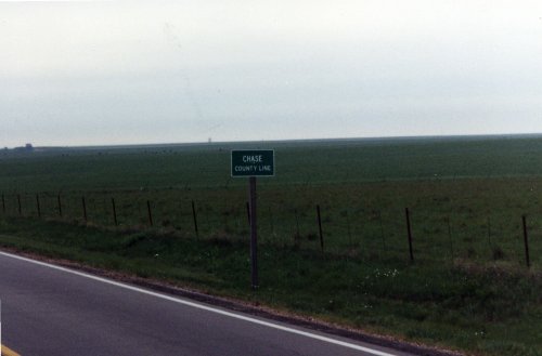
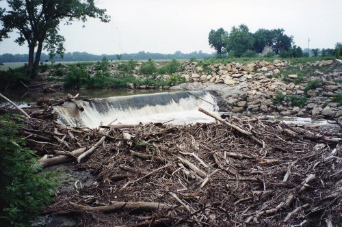
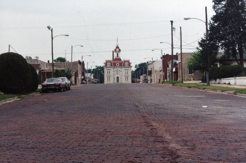
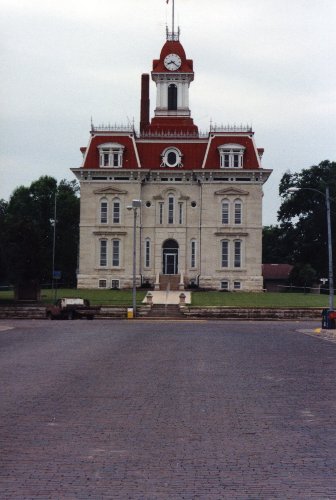 The county line to Chase County Kansas. The second picture is the falls on Cottonwood River. The third is Broadway, the main street in Cottonwood Falls, County Seat of Chase County, KS. and the last one on the right is a close view of the Country Court House, it is the oldest working courthouse west of the Mississippi.
17 May: Strong City, KS to Clayton, NM
Roads: US50, US50/56, US56, US56/64/412
Camp: Motel
Route
Nothing but miles and miles until I got into the Rita Blanca Grasslands on the OK, TX & NM border area where I started to see some foothills. The other sight for sore eyes was mountains once again, not tree covered hills but real mountains. It also settled something in my mind. I had left Sacramento with most of what I owned in the back seat and trunk of my car. There were some bigger items still in the basement of the house that I had lived in but I didn't need then to settle down someplace as my new home. I had looked at all of the country that I had been driving through as possible places to settle and found nothing that I liked better than Reno, which was to be my choice unless I found something I liked better. The mountains were that deciding factor, I need them around me to feel like I'm at home. So Reno, NV here I come!
18 May: Clayton, NM to Cortez, CO

Roads: US56, I-25, US84/285, US84, NM96, US550, NM544, NM574, NM170/CO140 & US160
Camp: Motel
Route
There were more antelope along US56 between Clayton and Springer, NM than I have ever seen before, they were everywhere in large herds. There was a lot more snow in the Rockies this year versus last. I drove through Santa Fe but did not stop, it looked much to touristy for my taste. I had a little light rain through the pass between Durango and Cortez but most of the time the view of the mountains was wonderful - it is good to be back among them. I did another 500+ mile day again today but don't feel as bad as some of them have been. Dinner at Nero's, the same place that I had dinner not quite a year ago.
19 May: Cortez, CO to Ely, NV

Roads: US491, US191,I-70/US50, US50, I-15/US50, US50 & US50/6
Camp: Motel
Route
Not much to say about today except it was miles and miles again (505 of them) with a lot of climbing of passes. Rough country with very few towns or other evidence that men live here.
20 May: Ely, to Sparks, NV
Roads: US50, AltUS50, I-80 & City Streets
Camp: Victorian Inn - for a week
Route
Today I was on 'The Loneliest Road in America', that is US50 across Nevada from Ely to Fallon. It was rough country like yesterday with range after range of mountains and basins between each of them. I checked into a motel that I saw on the main street through Sparks to Reno and got a room of one week. I'll start looking for an apartment and a job during this first week and then move in to something more permanent.